To see a list and map of all Voyage Communities, visit the Community Network main page.
Opening Date: May 8, 2024
Exhibition Type: Mark II (Generation 1 with customization upgrade)
Lead Institution: Hudson Valley Community College
Partner Institutions: none
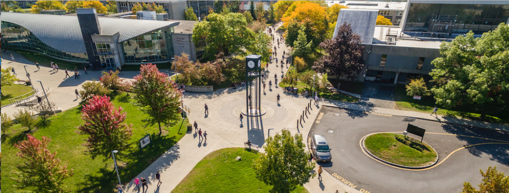
Location: Hudson Valley Community College campus
Overview
Established in 1953, Hudson Valley Community College (HVCC) is a public two-year institution located in the Capital Region, which is comprised of four counties (Albany, Rensselaer, Saratoga and Schenectady) and is the metropolitan area surrounding Albany, the capital of the state of NY. The Capital Region is a major anchor of the “Tech Valley,” which is a hub of technological companies and educational facilities encompassing 19 counties from Westchester County to the Canadian border. There are 54 public school districts and 26 colleges and universities that serve the Capital Region. HVCC is a premier STEM and technical college and offers career pathways to four-year degrees at all universities in the area. In addition, there are 20 designated low-income, opportunity zones served by the Capital Region; all in proximity to HVCC’s main campus.
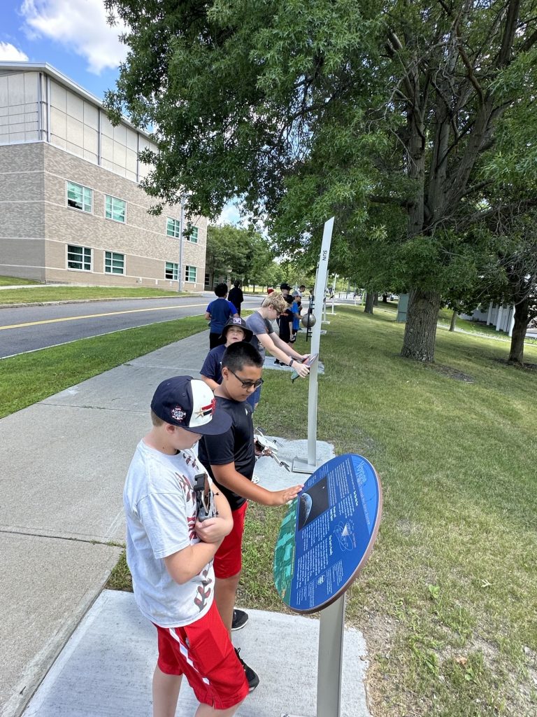
6th-8th grade students tour Voyage as part of HVCC’s Kids on Campus summer program. Click on Image to Zoom
HVCC is seeking to install the Voyage exhibition to help inspire more under-represented populations to consider careers in STEM fields. The Voyage exhibition will allow community members the experience of viewing and exploring the vastness of the Solar System and the unique and fragile position that Earth holds within it. HVCC will also provide experiential, age-appropriate learning activities to K-12 school groups and summer camps for community youth. Children will be given opportunities to engage in space exploration, decipher their place in the universe and how their world extends beyond community and national boundaries. In some cases, this exhibition will be their first STEM experience.
HVCC is located near several major highways, providing easy access to all surrounding counties and communities.
Implementation Plan
The National Center for Earth and Space Science Education would like to encourage a community to not just install a Voyage exhibition as a passive experience, but proactively put Voyage to work, with e.g., tours, both guided and self-guided, and classroom-based pre- and post-tour lessons on Solar System science and exploration. The community’s lead organization, working in concert with the other partner organizations, submits an Implementation Plan where all collectively propose how the Voyage exhibition and associated educational materials would be used in their community to address the Voyage Key Objectives (see Section 1 here), hopefully in perpetuity.
Download Troy, NY, Implementation Plan
Site Maps
To explore the maps below at high resolution, first click on the map and wait for it to load as a pop-up window. If you see the icon ![]() in the upper right corner of the window, you can click on it and explore at higher resolution. Alternatively, you can drag the pop-up window to your desktop to download. Once downloaded, Zoom in to view at higher resolution.
in the upper right corner of the window, you can click on it and explore at higher resolution. Alternatively, you can drag the pop-up window to your desktop to download. Once downloaded, Zoom in to view at higher resolution.
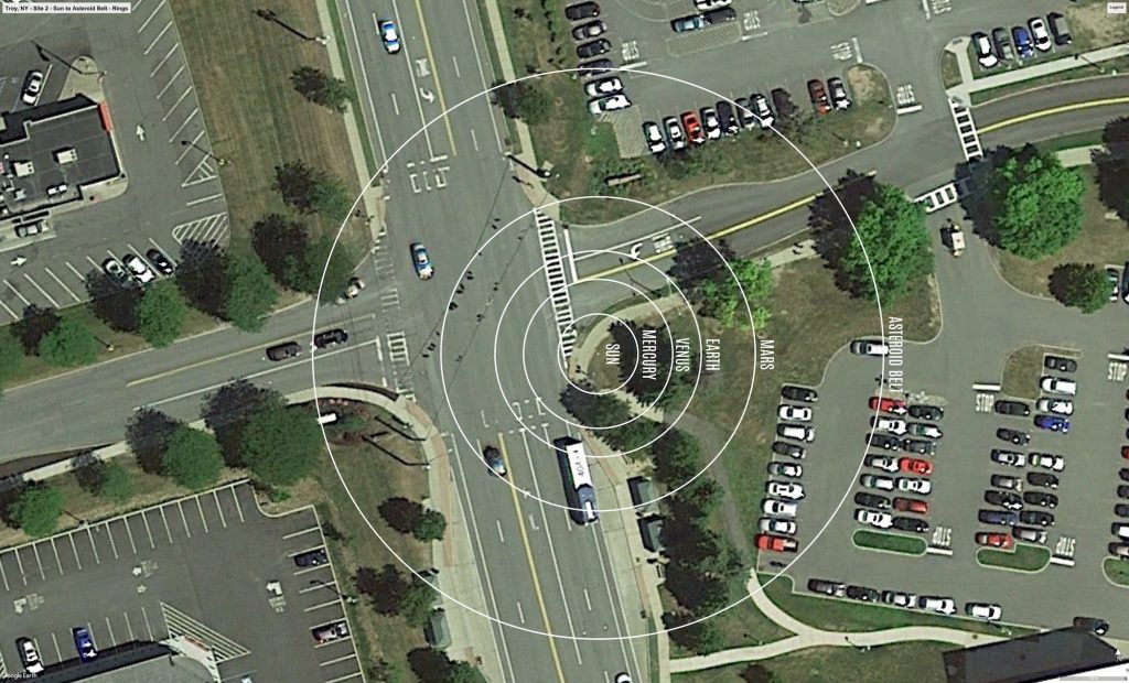
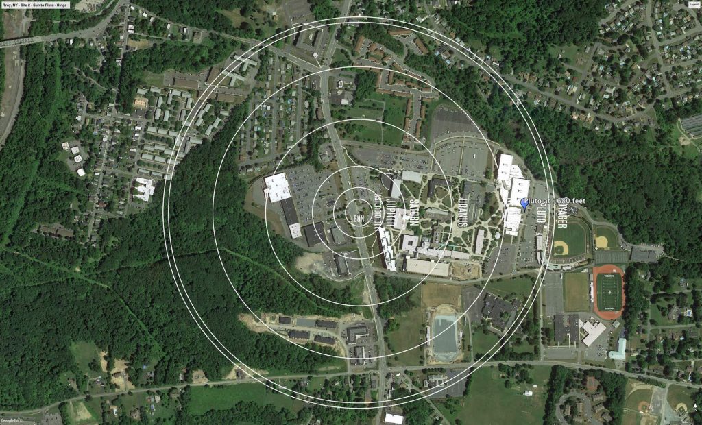
Preliminary Site Maps: To help a community understand how the Voyage model Solar System will lay out at the proposed site, the National Center for Earth and Space Science Education generates Preliminary Site Maps (PSMs), which overlay the proposed position of the Sun and orbits of the planets atop Google Earth images. The radii of the orbits are the average distances of the planets from the Sun at the 1 to 10-billion scale. The PSMs provide an understanding of where the orbits intersect walking paths, so that positions of the exhibitions’s 13 stanchions can be identified.
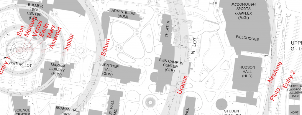
Formal Site Map: A Formal Site Map (FSM) is produced by the community using a CAD map of the site (if available) that is accurate at sub-meter resolution. The FSM identifies the precise locations of the exhibition’s 13 stanchions relative to local buildings, streets, pathways, and green spaces.
Custom Site Map: If a community has purchased a Customization Upgrade, each of the exhibition’s 13 storyboards includes a Custom Site Map (CSM) created by the designer for the Voyage National Program. The Formal Site Map provided by the community is used to create the CSM, which maintains the Voyage design aesthetic defined by style and color palette. The CSM provides the visitor with wayfinding information relative to local landmarks.

