To see a list and map of all Voyage Communities, visit the Community Network main page.
Opening Date: May 2, 2023
Exhibition Type: Mark II (Generation 1)
Lead Institution: City of Dover, NH
Partner Institutions:
Dover School District
Children’s Museum of New Hampshire
Location: southern end of the Dover Community Trail between the Fisher Street and Rutland Street trailheads
Overview
The City of Dover, situated on the seacoast of New Hampshire, is a community with a long and rich history spanning four centuries. The area is also the traditional ancestral homeland of the Abenaki, Pennacook, and Wabanaki Peoples.
With its historic mills, lively downtown, exceptional school system, and outstanding parks and recreation amenities, Dover is amongst the fasting-growing communities in the state. The community is nestled between the mountains and the ocean, close to the University of New Hampshire, Pease International Tradeport, it is a station community for the Amtrak Downeaster, and home to the Children’s Museum of New Hampshire and the Woodman Institute.
The Dover School District is made up of approximately 4,200 students and 600 employees. Three elementary schools educate students in grades K-4; a middle school serves students in grades 5-8 and a high school and career technical center serves students in grades 9-12 from Dover, Nottingham, and Barrington. The Dover Career and Technical Center provides students with an education that combines rigorous academic and technical study, preparing them for the world of work and continued education.
The Children’s Museum of New Hampshire has a mission to actively engage families in hands-on discovery and a vision to inspire all to become the next generation of innovator and creative thinkers.
Dover is excited about the Voyage Mark II Exhibit as it fosters a visual STEM educational experience for all ages, engages the community and visitors to think larger by serving as a reminder of Earth’s place in space, and provides a unique amenity for the region.
The Voyage Mark II is located along one of the newer segments of the Dover Community Trail. The Sun can be viewed from the trailhead near Fisher Street and Pluto is located at the trailhead near Rutland Street. This location is in walking distance from downtown, museums, the Transportation Center, three schools, and the UNH Wildcat Transit bus route. The trail is accessible and parking is available within the area.
The City of Dover, Dover School District, and the Children’s Museum of New Hampshire are proud to have made Dover, NH a Voyage Mark II community.
Implementation Plan
The National Center for Earth and Space Science Education would like to encourage a community to not just install a Voyage exhibition as a passive experience, but proactively put Voyage to work, with e.g., tours, both guided and self-guided, and classroom-based pre- and post-tour lessons on Solar System science and exploration. The community’s lead organization, working in concert with the other partner organizations, submits an Implementation Plan where all collectively propose how the Voyage exhibition and associated educational materials would be used in their community to address the Voyage Key Objectives (see Section 1 here), hopefully in perpetuity.
Download Dover, NH, Implementation Plan
Noteworthy
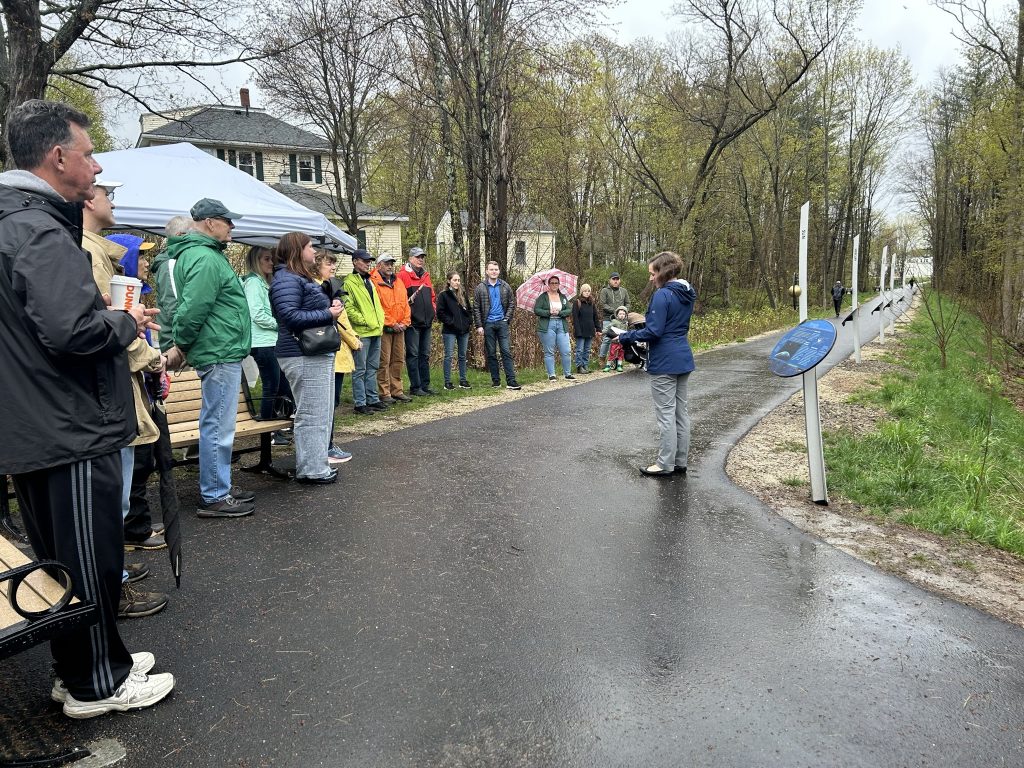
The City of Dover created a Voyage activity sheet for kids to promote visits and engagement. It is available on the City website, at Dover City Hall, and the Dover Public Library. Download Voyage Activity
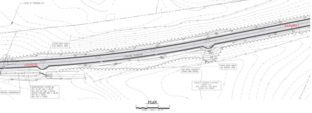
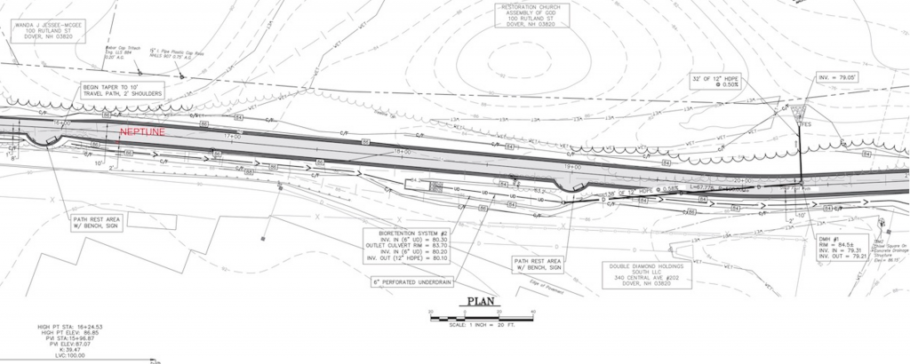
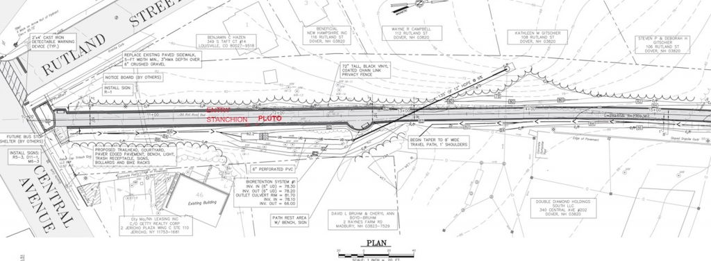
Site Maps
To explore the maps below at high resolution, first click on the map and wait for it to load as a pop-up window. If you see the icon ![]() in the upper right corner of the window, you can click on it and explore at higher resolution. Alternatively, you can drag the pop-up window to your desktop to download. Once downloaded, Zoom in to view at higher resolution.
in the upper right corner of the window, you can click on it and explore at higher resolution. Alternatively, you can drag the pop-up window to your desktop to download. Once downloaded, Zoom in to view at higher resolution.
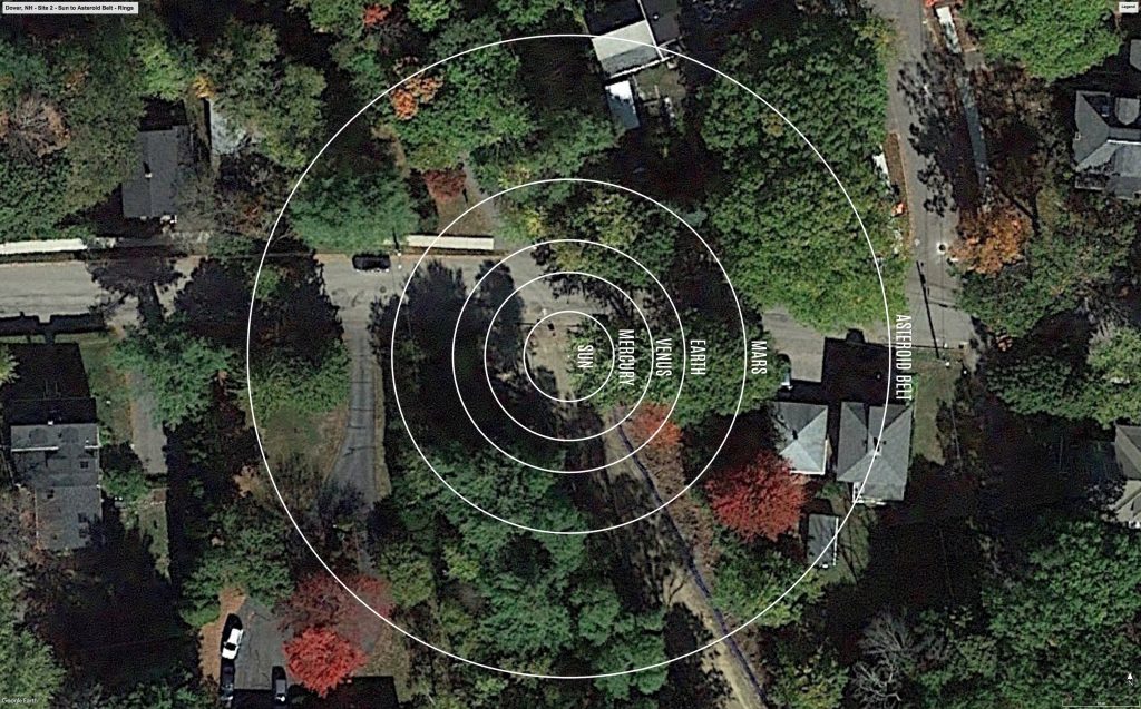
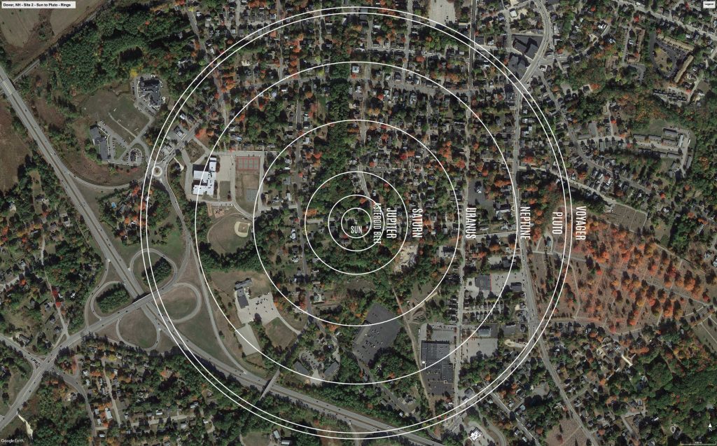
Preliminary Site Maps: To help a community understand how the Voyage model Solar System will lay out at the proposed site, the National Center for Earth and Space Science Education generates Preliminary Site Maps (PSMs), which overlay the proposed position of the Sun and orbits of the planets atop Google Earth images. The radii of the orbits are the average distances of the planets from the Sun at the 1 to 10-billion scale. The PSMs provide an understanding of where the orbits intersect walking paths, so that positions of the exhibitions’s 13 stanchions can be identified.
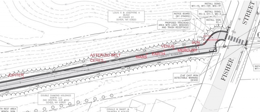
Formal Site Maps: A Formal Site Map (FSM) is produced by the community using a CAD map of the site (if available) that is accurate at sub-meter resolution. The FSM identifies the precise locations of the exhibition’s 13 stanchions relative to local buildings, streets, pathways, and green spaces.


