Clcik on Image to Zoom
To see a list and map of all Voyage Communities, visit the Community Network main page.

Opening Date: December 8, 2021
Exhibition Type: Mark II (Generation 0 with customization upgrade)
Lead Institution:University of Colorado Boulder
– Fiske Planetarium
– Sommers-Bausch Observatory
– Department of Astrophysical & Planetary Sciences
Partner Funding Organizations:
CU Grand Challenge
Big Kid Science
CU Office of the Chancellor
Laboratory for Atmospheric & Space Physics
Department of Astrophysical & Planetary Sciences
Department of Aerospace Engineering
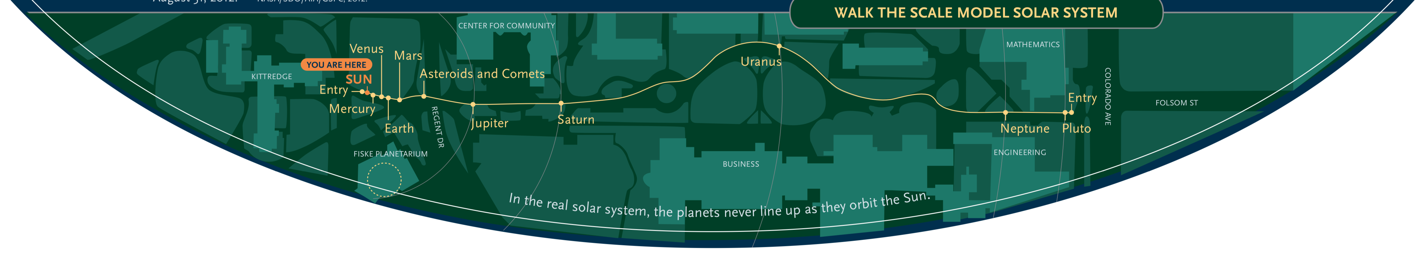
Location: University of Colorado, Boulder campus, along the path from Fiske Planetarium to the Engineering Center near the intersection of Colorado Ave. and Folsom St.
Overview
Find Your Place Iin Space Event, 4/12/24. Click on Image to Zoom
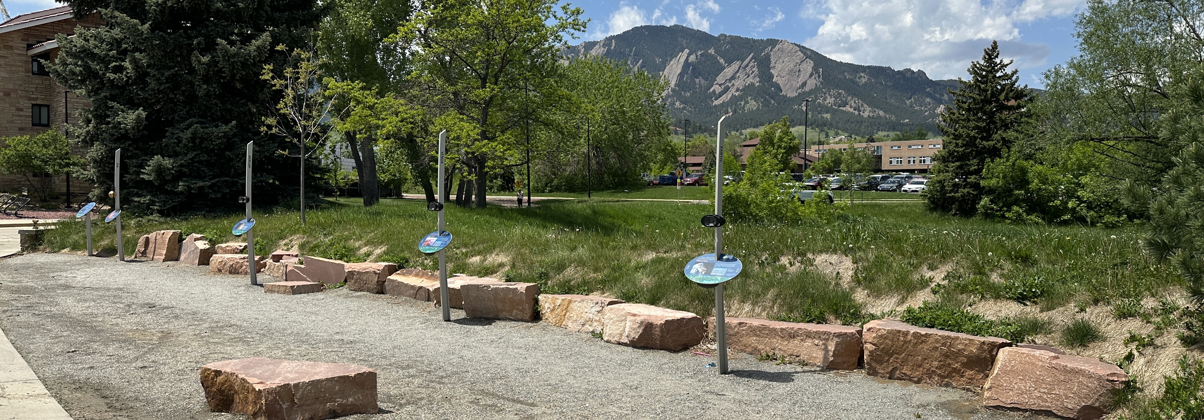
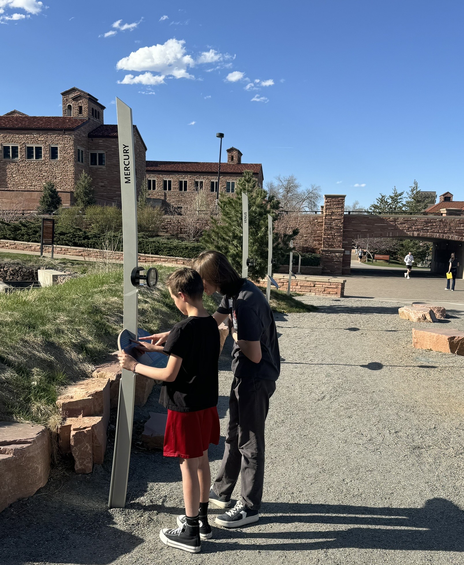
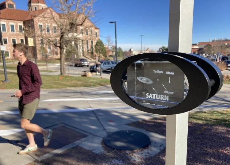
The Colorado Scale Model Solar System (CSMSS; pictured above) was originally installed at the University of Colorado Boulder (CU Boulder) in 1987 by a team led by members of the CU Department of Astrophysical, Planetary, and Atmospheric Sciences. During its time at CU Boulder, the CSMSS has served as an educational resource and a lasting memorial for the Space Shuttle Challenger crew, particularly CU alumnus Ellison Onizuka. Moreover, due to its popularity on CU Boulder’s campus, the CSMSS led directly to the original Voyage Mark I model on the Mall in Washington, DC (see the Voyage National Program Heritage Page for more information).
Now, after more than three decades, the original model is being upgraded with the first installation of a Voyage Mark II model. We hope that the new Voyage Mark II will remain a vibrant public exhibition for decades to come, while also inspiring future domestic and international Voyage installations.
The original CSMSS will retain its black granite dedication pyramid, which formerly housed the model Sun at its apex. The pyramid will continue to honor the Challenger astronauts, but will also be updated to honor the Space Shuttle Columbia crew, including CU alumna Dr. Kalpana Chawla. This memorial will be moved to a new location adjacent to the new Voyage Mark II.
The new installation of the Voyage Mark II model will continue the CSMSS legacy of serving both as a public art installation/memorial and as an educational exhibition.
Click on Image to Zoom
Currently, more than 1,000 CU students tour and study the existing model each year as part of their undergraduate astronomy coursework, an additional 1,000 younger students visit the model in conjunction with K-12 field trips to Fiske Planetarium, and tens of thousands more from the general public visit to enjoy the model during formal or informal campus tours. We hope that in this way, the Colorado model will continue to inspire individuals to develop a “cosmic perspective” that recognizes the importance of treating each other — and our planet Earth — with kindness and respect.
Noteworthy
– A Lab Activity for the CSMSS for an introductory astronomy class aimed at non-science majors.
Site Maps
To explore the maps below at high resolution, first click on the map and wait for it to load as a pop-up window. If you see the icon ![]() in the upper right corner of the window, you can click on it and explore at higher resolution. Alternatively, you can drag the pop-up window to your desktop to download. Once downloaded, Zoom in to view at higher resolution.
in the upper right corner of the window, you can click on it and explore at higher resolution. Alternatively, you can drag the pop-up window to your desktop to download. Once downloaded, Zoom in to view at higher resolution.
Preliminary Site Maps: To help a community understand how the Voyage model Solar System will lay out at the proposed site, the National Center for Earth and Space Science Education generates Preliminary Site Maps (PSMs), which overlay the proposed position of the Sun and orbits of the planets atop Google Earth images. The radii of the orbits are the average distances of the planets from the Sun at the 1 to 10-billion scale. The PSMs provide an understanding of where the orbits intersect walking paths, so that positions of the exhibitions’s 13 stanchions can be identified.

The Inner Solar System orbits out to the Asteroid Belt.
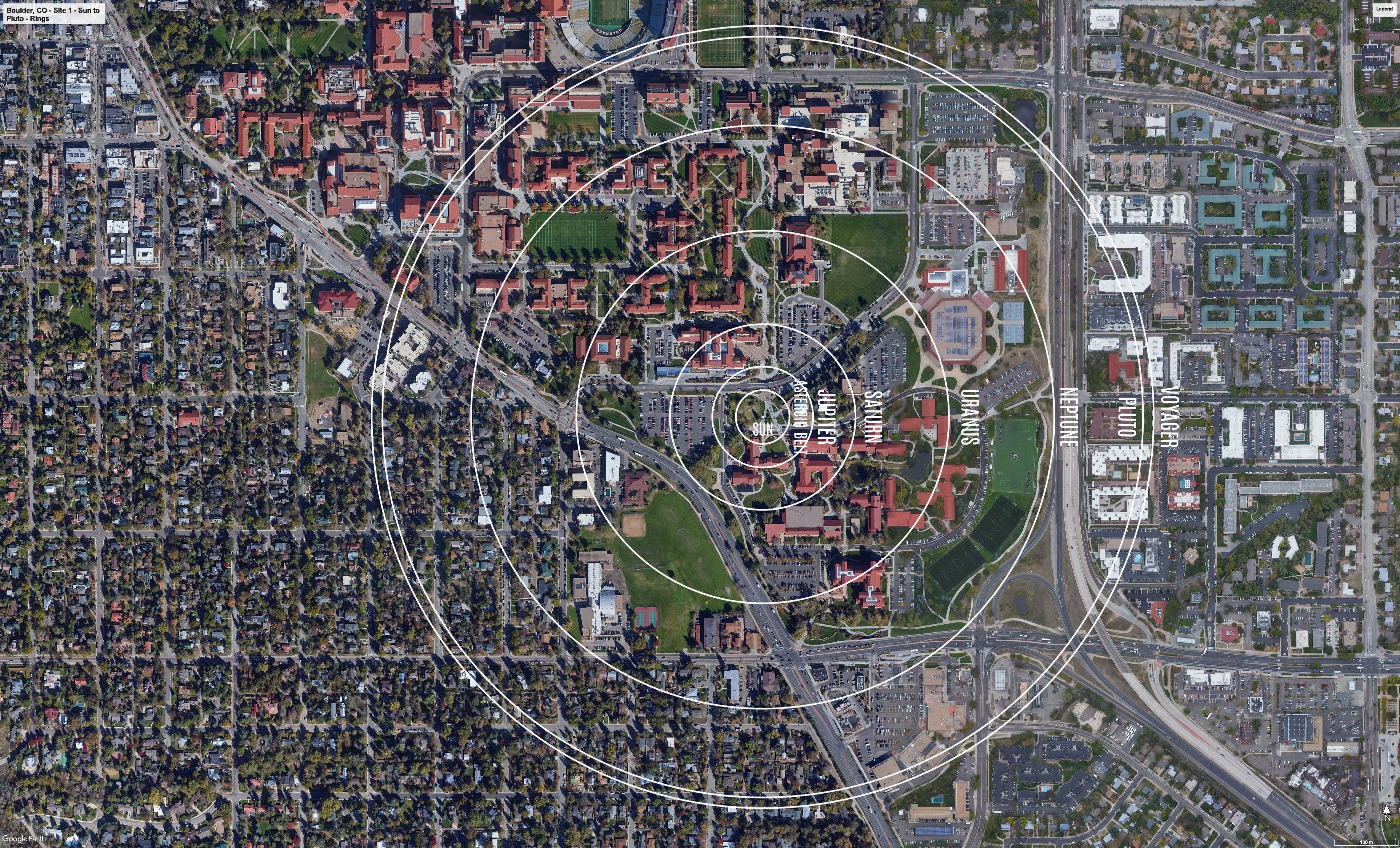
The Outer Solar System orbits from the Asteroid Belt out to Pluto.
Formal Site Map: A Formal Site Map (FSM) is produced by the community using a CAD map of the site (if available) that is accurate at sub-meter resolution. The FSM identifies the precise locations of the exhibition’s 13 stanchions relative to local buildings, streets, pathways, and green spaces.
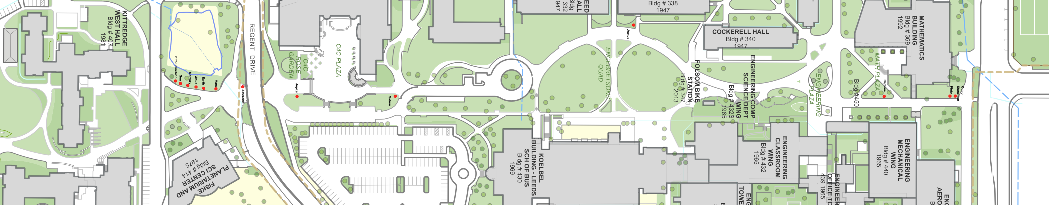
Custom Site Map: If a community has purchased a Customization Upgrade, each of the exhibition’s 13 storyboards includes a Custom Site Map (CSM) created by the designer for the Voyage National Program. The Formal Site Map provided by the community is used to create the CSM, which maintains the Voyage design aesthetic defined by style and color palette. The CSM provides the visitor with wayfinding information relative to local landmarks.