To see a list and map of all Voyage Communities, visit the Community Network main page.![]()
Opening Date: September 6, 2023
Exhibition Type: Mark II (Generation 1 with customization upgrade)
Lead Institution: Nunez Community College
![]()
![]()
Partner Institutions:
Meraux Foundation
St. Bernard Parish Tourist Commission
Location: Nunez Community College campus
Overview
Click on Image to Zoom
Nestled just outside New Orleans, St. Bernard Parish offers visitors a chance to experience the region’s rich culture, which is steeped in over two hundred years of history and tradition.
The parish (San Bernardo) was originally settled in Spanish Louisiana between 1778 and 1783 by colonists from the Canary Islands. These settlers, known as Isleños, brought with them their own culture, history, food, language, and customs, many of which have been retained into the twenty-first century.
The Battle of New Orleans, the final battle of the War of 1812, was fought in the parish. Today, the site is part of the Jean Lafitte National Historical Park and Preserve, recognizing its importance as a historic landmark and preserving the battlefield to educate visitors about its role in American history.
However, for all its rich history, St. Bernard Parish is also hub of innovation and opportunity, blending its rich traditions with a forward-looking vision.
Click on Image to Zoom
Nunez Community College in Chalmette, Louisiana, is the only institution of higher education in St. Bernard Parish, but it serves the entire New Orleans metropolitan region by providing an array of unique academic and technical education programs that train students for a variety of fields that power Louisiana’s economic engine, including healthcare, energy production, information technology, the skilled trades, and aerospace manufacturing, which literally teaches students to build rockets that will take astronauts to the Moon and beyond. Students of the Nunez Aerospace Manufacturing program are trained as technicians for a variety aerospace and advanced manufacturing positions, as well as for the storied Michoud Assembly Facility (MAF), which is only an eight-minute drive from the college campus.
Michoud, known as NASA’s “rocket factory” and the nation’s premiere site for manufacturing and assembling large-scale space structures and systems, is currently building the next generation of rockets as part of NASA’s Orion Project. Orion spacecraft will launch on NASA’s new heavy-lift rocket, the Space Launch System (SLS), which Nunez students help to build.
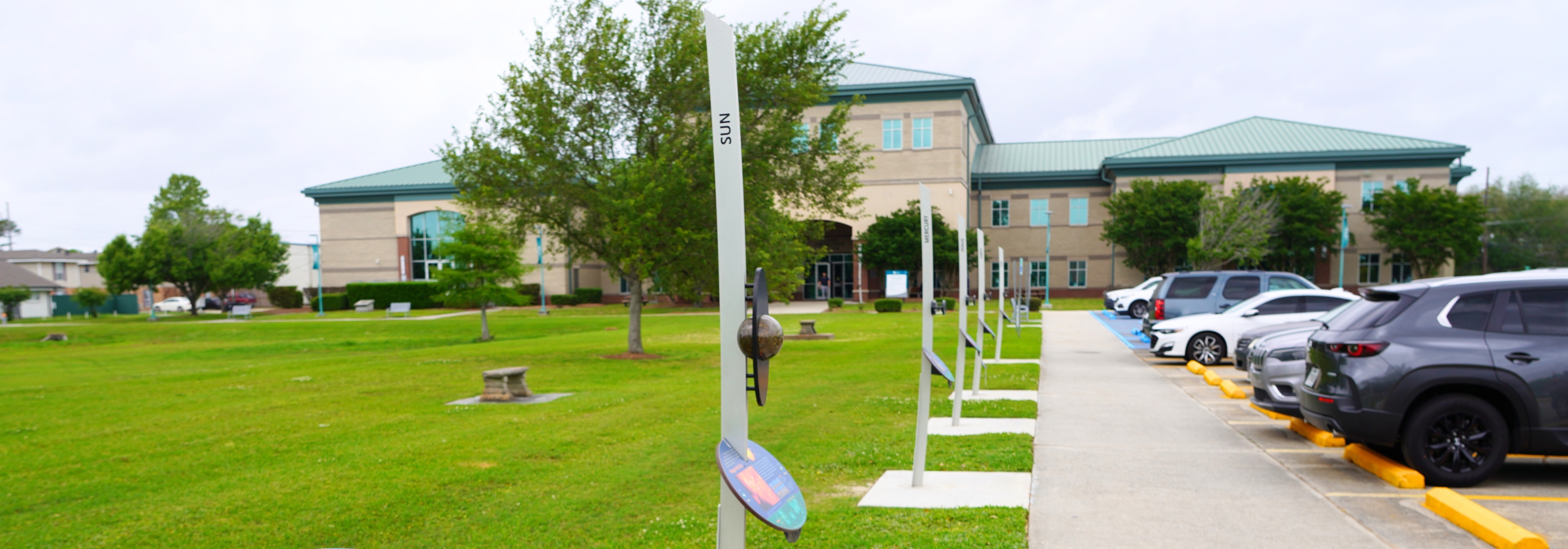
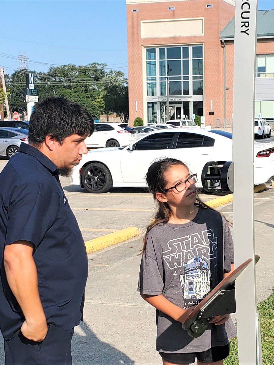
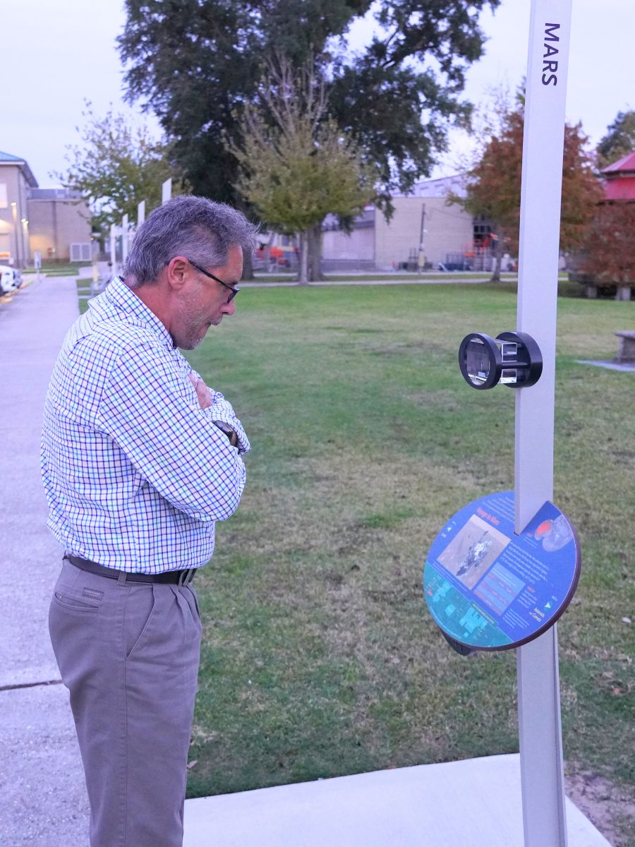
This collaboration between Nunez and Michoud not only brings highly skilled technicians and high-tech jobs to the region, but it also fosters a spirit of innovation and educational opportunities for local students and residents. Nunez’s Voyage Mark II exhibition shares the same goal. It gives students, families, educators, and the public a place to gather and engage with each other, ponder the wonders of space, and dream of the places scientific innovation will take humankind next.
Implementation Plan
The National Center for Earth and Space Science Education would like to encourage a community to not just install a Voyage exhibition as a passive experience, but proactively put Voyage to work, with e.g., tours, both guided and self-guided, and classroom-based pre- and post-tour lessons on Solar System science and exploration. The community’s lead organization, working in concert with the other partner organizations, submits an Implementation Plan where all collectively propose how the Voyage exhibition and associated educational materials would be used in their community to address the Voyage Key Objectives (see Section 1 here), hopefully in perpetuity.
Download Chalmette, LA, Implementation Plan
Site Maps
To explore the maps below at high resolution, first click on the map and wait for it to load as a pop-up window. If you see the icon ![]() in the upper right corner of the window, you can click on it and explore at higher resolution. Alternatively, you can drag the pop-up window to your desktop to download. Once downloaded, Zoom in to view at higher resolution.
in the upper right corner of the window, you can click on it and explore at higher resolution. Alternatively, you can drag the pop-up window to your desktop to download. Once downloaded, Zoom in to view at higher resolution.
Preliminary Site Maps: To help a community understand how the Voyage model Solar System will lay out at the proposed site, the National Center for Earth and Space Science Education generates Preliminary Site Maps (PSMs), which overlay the proposed position of the Sun and orbits of the planets atop Google Earth images. The radii of the orbits are the average distances of the planets from the Sun at the 1 to 10-billion scale. The PSMs provide an understanding of where the orbits intersect walking paths, so that positions of the exhibitions’s 13 stanchions can be identified.
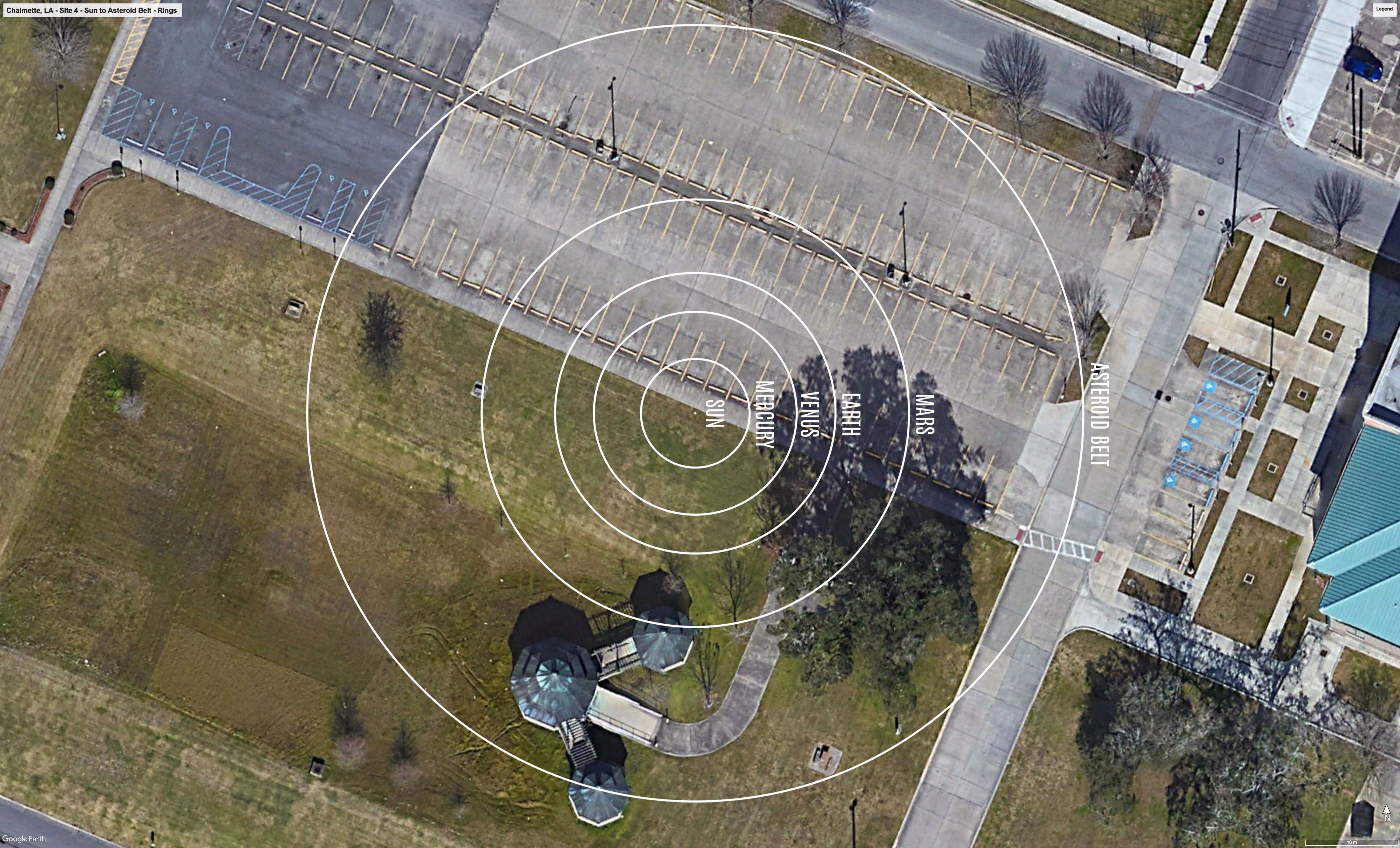
The Inner Solar System orbits out to the Asteroid Belt.
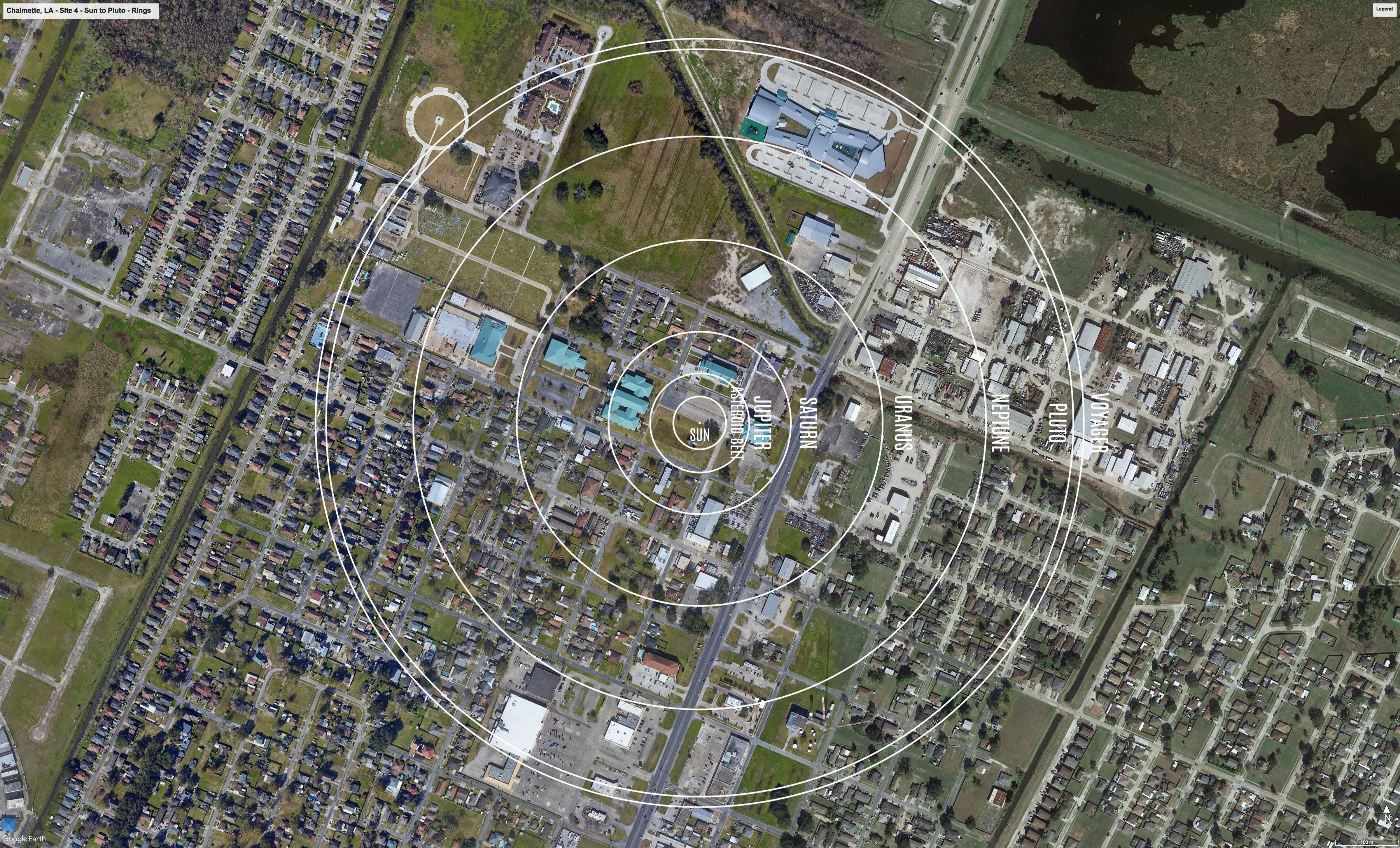
The Outer Solar System orbits from the Asteroid Belt out to Pluto.
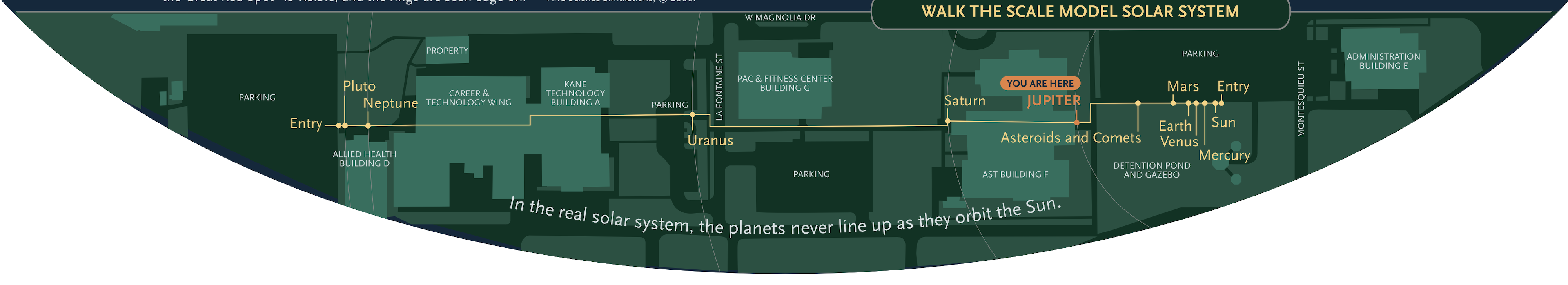
Formal Site Map: A Formal Site Map (FSM) is produced by the community using a CAD map of the site (if available) that is accurate at sub-meter resolution. The FSM identifies the precise locations of the exhibition’s 13 stanchions relative to local buildings, streets, pathways, and green spaces.
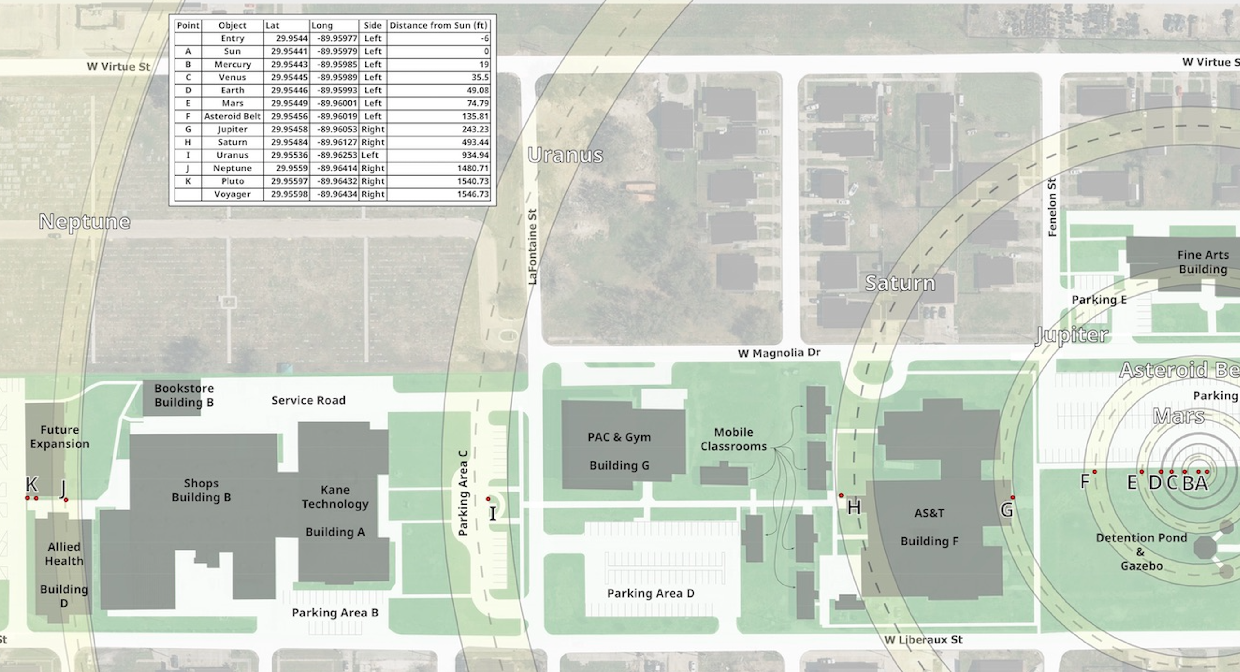
Custom Site Map: If a community has purchased a Customization Upgrade, each of the exhibition’s 13 storyboards includes a Custom Site Map (CSM) created by the designer for the Voyage National Program. The Formal Site Map provided by the community is used to create the CSM, which maintains the Voyage design aesthetic defined by style and color palette. The CSM provides the visitor with wayfinding information relative to local landmarks.