To see a list and map of all Voyage Communities, visit the Community Network main page.
Opening Date: March 24, 2023
Exhibition Type: Mark II (Generation 1 with customization upgrade)
Lead Institution: Department of Physics and Materials Science at The University of Memphis
Partner Institutions:
Tennessee Space Grant Consortium
University of Memphis Campus Community
Big Kid Science
Memphis Astronomical Society
Location: The University of Memphis main campus
Overview
Located on the banks of the Mississippi River in the Southwest corner of TN, Memphis borders Mississippi and Arkansas. The largest city in the Mid-South, it is a hub for international cargo and trade. Memphis marked its 200th anniversary in 2019 and is a regional center for medicine, education, and the arts. The metro area is home to a diverse population of over a million people.
Click on Image to Zoom
Clcik on Image to Zoom

Clcik on Image to Zoom
Located in a quiet residential neighborhood of Memphis, Tennessee, the University of Memphis is a major research institution and is in the top tier among public universities in the 2020 U.S. News and World Report rankings. Founded in 1912 as West Tennessee State Normal School, we welcome more than 21,000 students to campus every year and offer over 250 degree programs. Diversity is one of our strengths. Students and faculty come from all over the world to be a part of the UofM experience.
Our goal in the Department of Physics and Materials Science is to advance scientific knowledge and innovation while at the same time educating the next generation of talented scientists. Our dedicated faculty supports this mission with cutting-edge research, unique programs, and a supportive learning environment. Our undergraduate students are encouraged to participate in research as early as their freshman year. We welcome school groups to visit our department to see our labs and talk with our faculty.
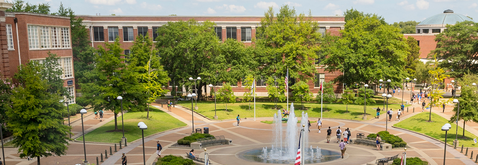
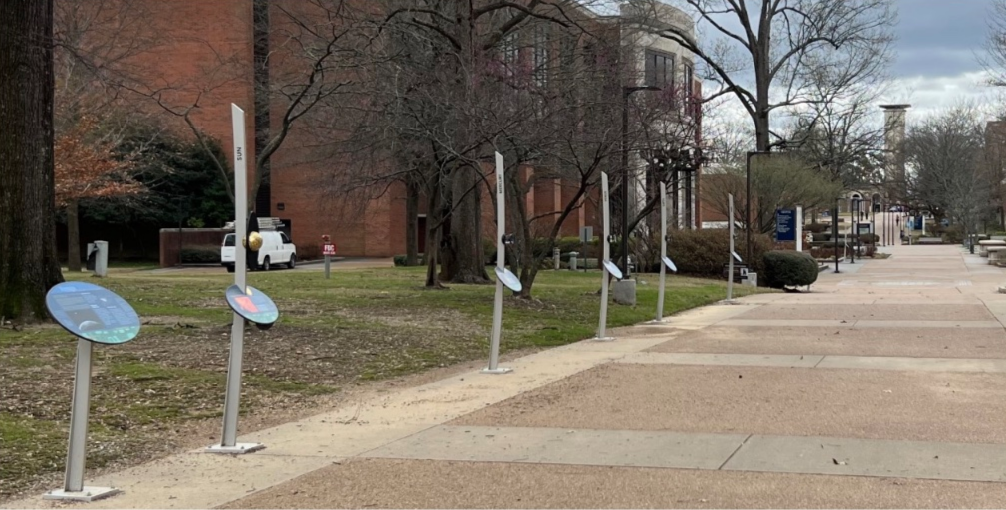
The Voyage Solar System Model is located on our main campus along a North-South primary walkway and allows UM students of all majors the rare opportunity to experience Earth’s place within our Solar System from new perspectives that inspire wonder and awe. It helps students comprehend how small and fragile Earth is within the tremendous breadth of our Solar System, and also how unique Earth is in its ability to provide the resources needed to sustain life as we know it. This awareness can help students see themselves as active participants in the Universe, making choices that matter for the future of life on Earth. Such a perspective can motivate students to seek more collaborative and sustainable solutions to environmental and social challenges.
The Voyage Solar System Model provides a focal point for STEM education and careers for our college students as well as for the K-12 community. School groups from around the Mid-South can visit our campus when they study the Solar System and gain the amazing perspective that the Voyage experience provides. Follow-up tours, activities and discussions with UM faculty can focus student energy on addressing the challenges that we have here on Earth, and also provide a foundation for the continued exploration of our solar system.
Implementation Plan
The National Center for Earth and Space Science Education would like to encourage a community to not just install a Voyage exhibition as a passive experience, but proactively put Voyage to work, with e.g., tours, both guided and self-guided, and classroom-based pre- and post-tour lessons on Solar System science and exploration. The community’s lead organization, working in concert with the other partner organizations, submits an Implementation Plan where all collectively propose how the Voyage exhibition and associated educational materials would be used in their community to address the Voyage Key Objectives (see Section 1 here), hopefully in perpetuity.
Download Memphis, TN, Implementation Plan
Noteworthy
– A search for “Memphis Voyage Solar System” on Google Maps produces a map with the location of the Sun and directions.
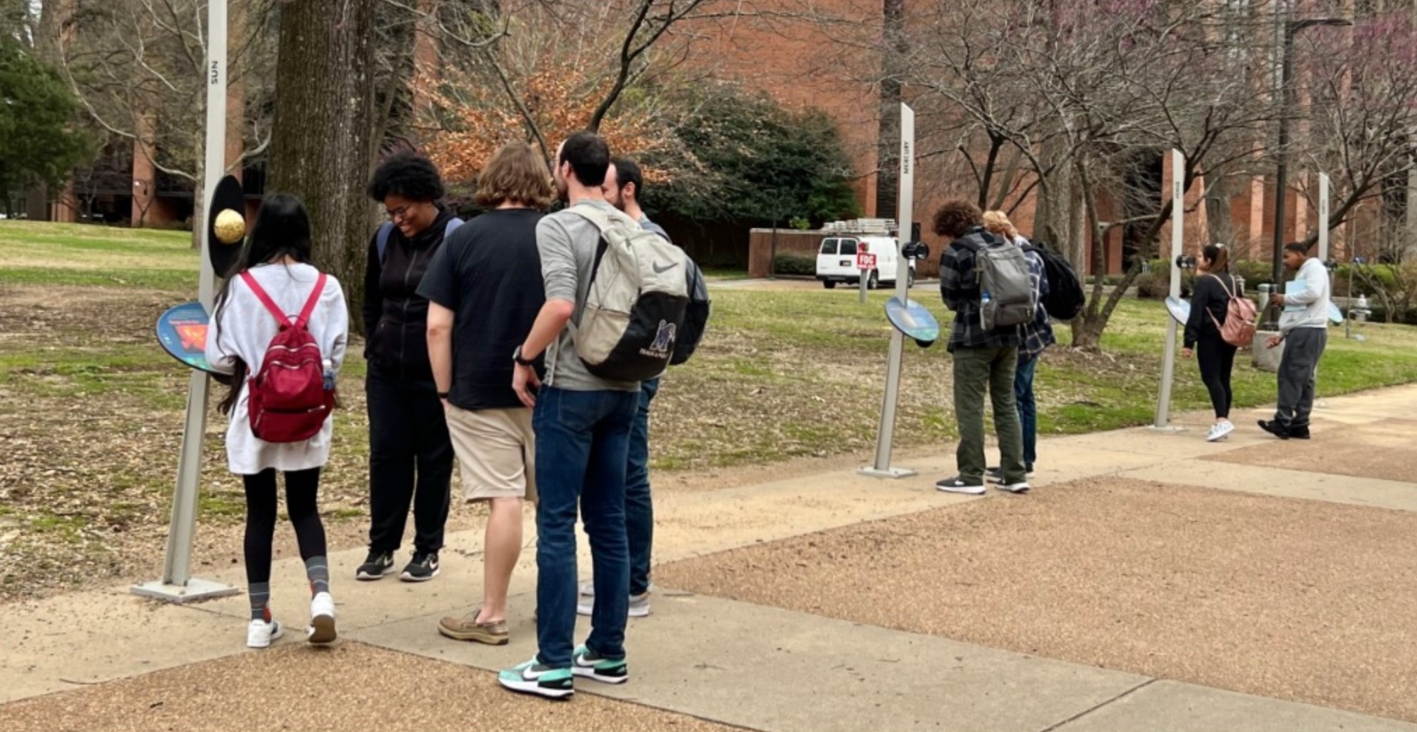
– Tour Activity: A Speed of Light robot moves at the scaled speed of light, which is 1 inch per second for a 1 to 10-billion scale model. The robot travels from the model Sun to model Earth in 8 mins, which is the light travel time from the real Sun to Earth. Over the 8 minutes travel time, a tour of the inner solar system is given to visitors.
– Tour Activity: Visitors view the model Sun from the model Earth and note how large it appears. Using eclipse glasses, visitors view the real Sun from Earth and see that the real Sun appears the same size as the model Sun.
– Self-Guided Tour Activity: Visitors with smartphones can use the camera to image a QR code at each stanchion and view a short tour presentation for that stanchion.
Site Maps
To explore the maps below at high resolution, first click on the map and wait for it to load as a pop-up window. If you see the icon ![]() in the upper right corner of the window, you can click on it and explore at higher resolution. Alternatively, you can drag the pop-up window to your desktop to download. Once downloaded, Zoom in to view at higher resolution.
in the upper right corner of the window, you can click on it and explore at higher resolution. Alternatively, you can drag the pop-up window to your desktop to download. Once downloaded, Zoom in to view at higher resolution.
Preliminary Site Maps: To help a community understand how the Voyage model Solar System will lay out at the proposed site, the National Center for Earth and Space Science Education generates Preliminary Site Maps (PSMs), which overlay the proposed position of the Sun and orbits of the planets atop Google Earth images. The radii of the orbits are the average distances of the planets from the Sun at the 1 to 10-billion scale. The PSMs provide an understanding of where the orbits intersect walking paths, so that positions of the exhibitions’s 13 stanchions can be identified.
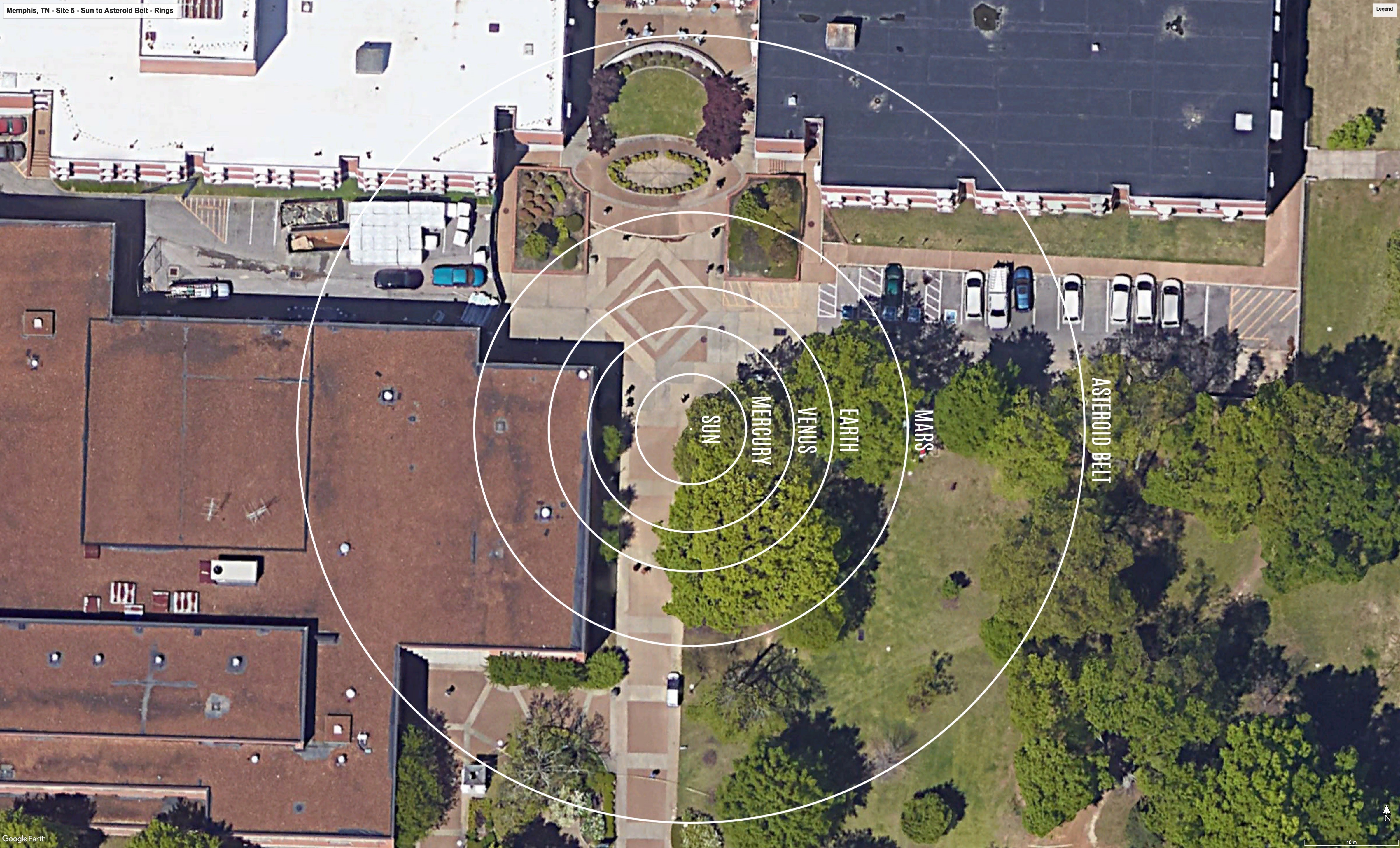
The Inner Solar System orbits out to the Asteroid Belt.
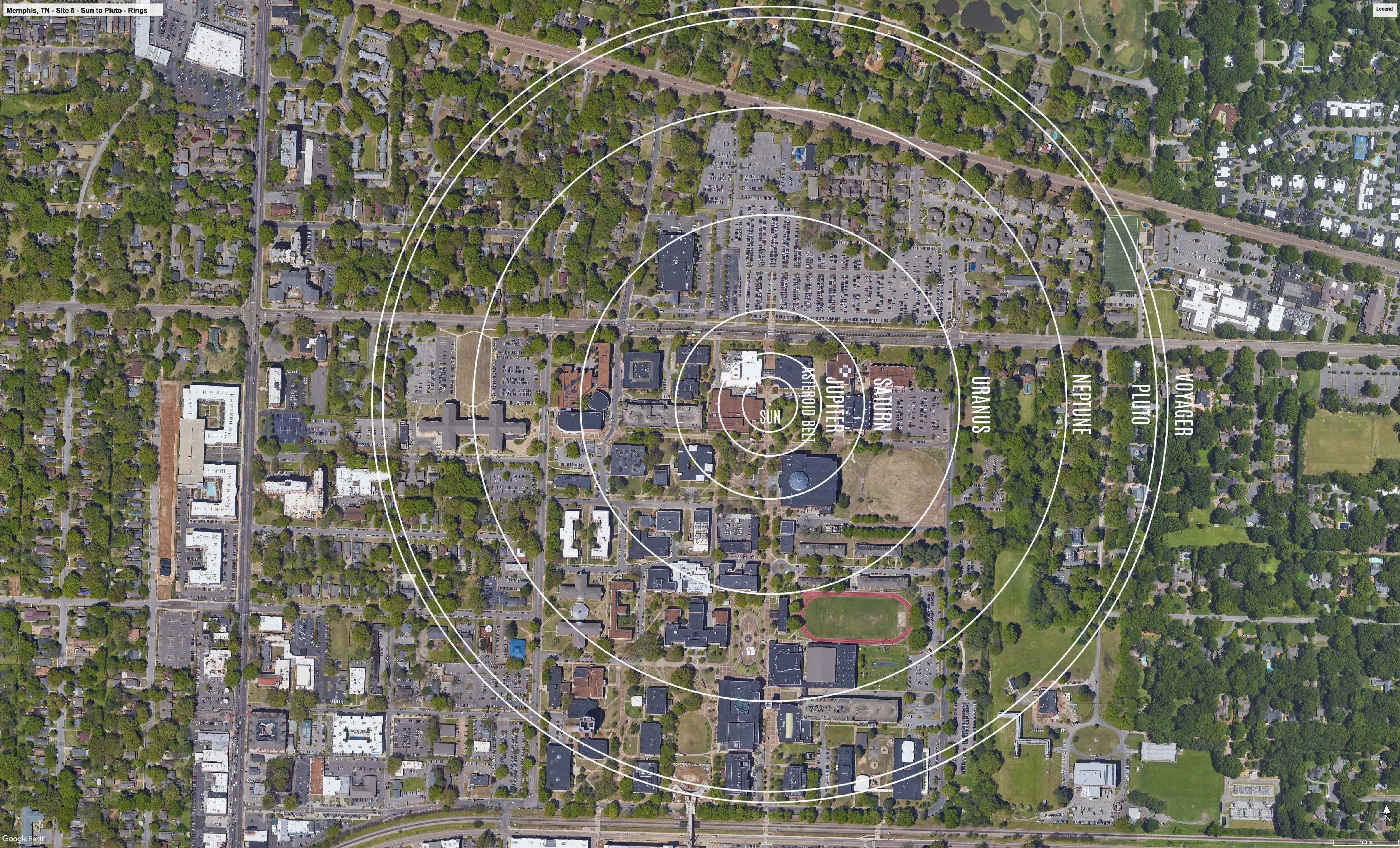
The Outer Solar System orbits from the Asteroid Belt out to Pluto.
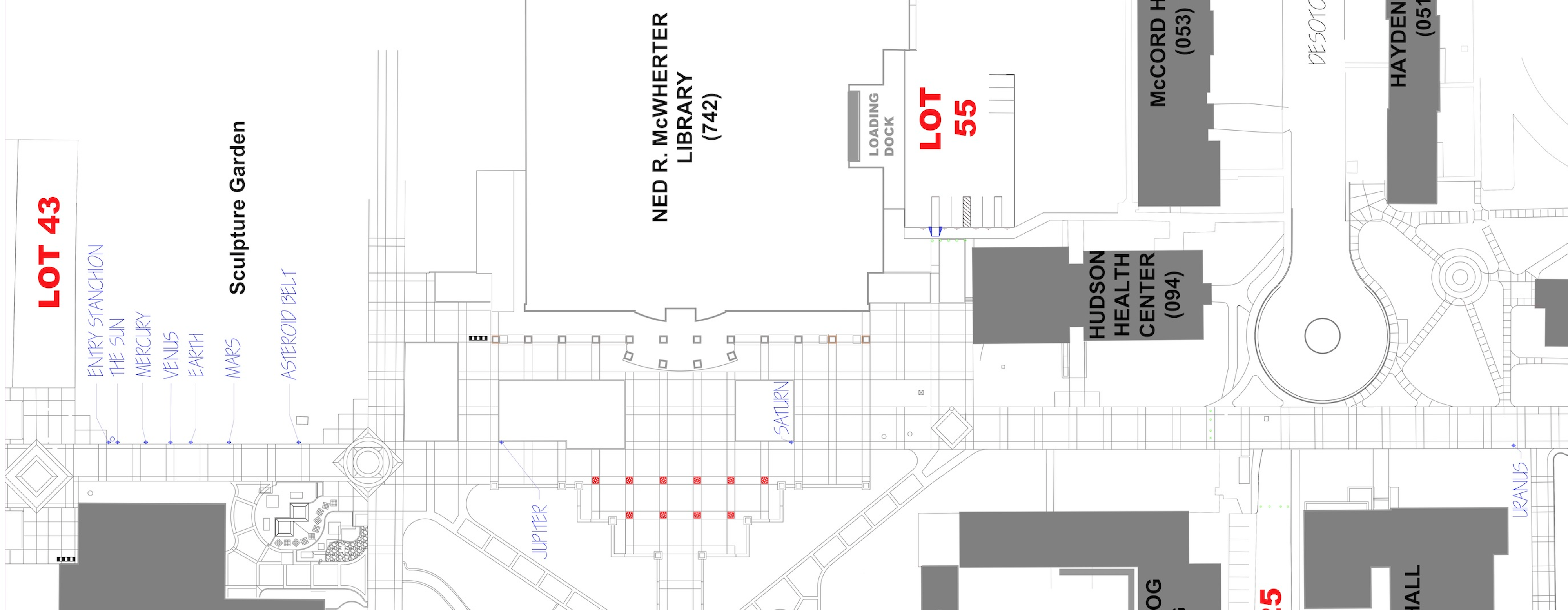
Formal Site Maps: A Formal Site Map (FSM) is produced by the community using a CAD map of the site (if available) that is accurate at sub-meter resolution. The FSM identifies the precise locations of the exhibition’s 13 stanchions relative to local buildings, streets, pathways, and green spaces.
Sun to Uranus

Uranus to Pluto
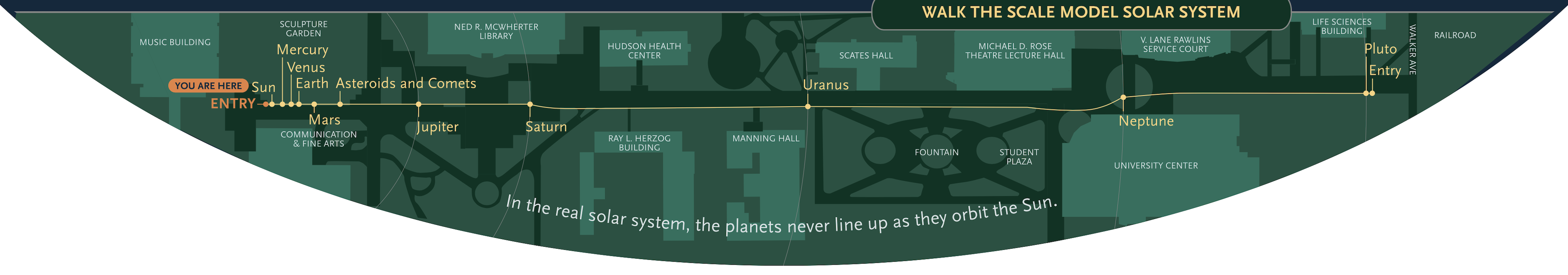
Custom Site Map: If a community has purchased a Customization Upgrade, each of the exhibition’s 13 storyboards includes a Custom Site Map (CSM) created by the designer for the Voyage National Program. The Formal Site Map provided by the community is used to create the CSM, which maintains the Voyage design aesthetic defined by style and color palette. The CSM provides the visitor with wayfinding information relative to local landmarks.