
To see a list and map of all Voyage Communities, visit the Community Network main page.![]()
Opening Date: May 14, 2022
Exhibition Type: Mark II (Generation 0 with customization upgrade)
Lead Institution:Palo Alto Junior Museum & Zoo
Partner Institutions:
City of Palo Alto
Friends of the Palo Alto Junior Museum & Zoo
Palo Alto Open Space and Parks
Palo Alto Art Center
Palo Alto Libraries
Big Kid Science
Location: Rinconada Park in City of Palo Alto
Overview
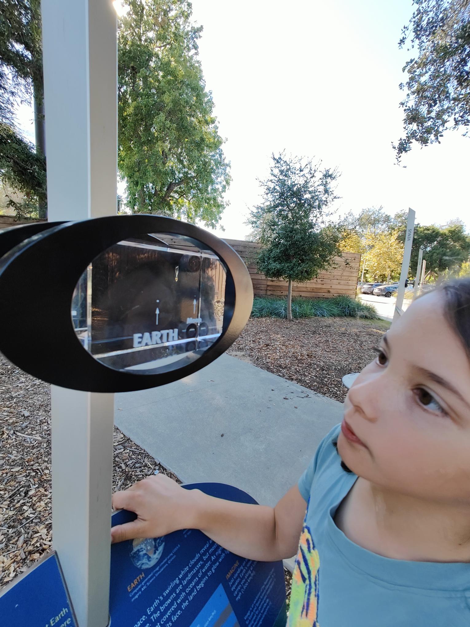
The Junior Museum and Zoo of Palo Alto (JMZ), which is owned and operated by the City of Palo Alto, has been a leader in science education for children since 1934. The museum’s mission is to engage a child’s curiosity in science and nature. Nestled in Rinconada Park, the JMZ was recently rebuilt from the ground-up and will open in Fall 2021. It excels in hands-on exhibits and programs for children that advance their understanding of science and nurture their inner scientist.
Click on Image to Zoom
Click on Image to Zoom
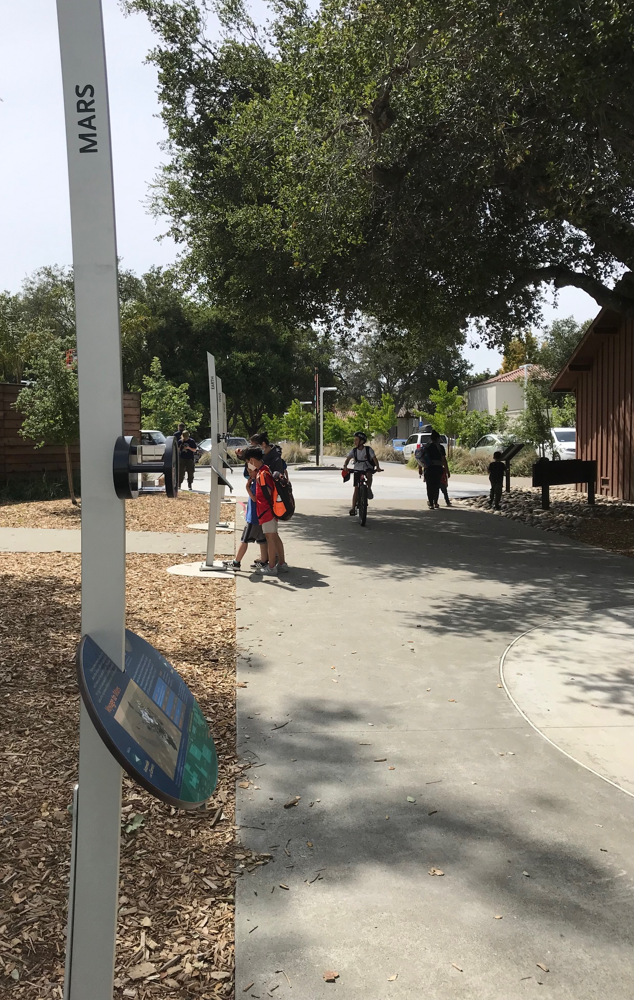
Rinconada Park and the nearby environs are a hub for community activities. The Rinconada area houses a community center, two performing arts theaters, two public libraries, the JMZ, the Palo Alto Art Center, both Boy Scout and Girl Scout meeting spaces, community gardens, and several recreational facilities including a public swimming pool, tennis courts, and playgrounds. Within this vibrant, active location, the Voyage Solar System model will be frequently and casually encountered by citizens going about daily activities. It is close to many colleges, including Menlo College and Stanford University within a few miles.
Our core objective for the Voyage exhibition is to excite visitors of all ages about the wonders of the universe. This beautifully designed and precise model resonates with the JMZ’s commitment to scientific accuracy even for our youngest children. The high-quality, off-the-shelf exhibition helps the JMZ accomplish its goal to offer free science exhibits outside the museum walls.
A local professor and teacher captures the impact best:
A solar system walk would be a fantastic resource for the community – a way to give people a sense of the vast scale of our solar system and embed science learning in a casual stroll through the park. I will be sure to add the walk to the list of community science resources that I distribute to my students.
– Prof. Geoff Matthews, Astronomy, Foothills College
One of the things I always found so difficult about teaching kids about space is the insane, impossible distances. I am so glad they are installing this solar system model as it should make the surreal just a little more real… while still blowing their unsuspecting, little minds!
– Pamela Dorrell, retired early education science teacher
Site Maps
To explore the maps below at high resolution, first click on the map and wait for it to load as a pop-up window. If you see the icon ![]() in the upper right corner of the window, you can click on it and explore at higher resolution. Alternatively, you can drag the pop-up window to your desktop to download. Once downloaded, Zoom in to view at higher resolution.
in the upper right corner of the window, you can click on it and explore at higher resolution. Alternatively, you can drag the pop-up window to your desktop to download. Once downloaded, Zoom in to view at higher resolution.
Preliminary Site Maps: To help a community understand how the Voyage model Solar System will lay out at the proposed site, the National Center for Earth and Space Science Education generates Preliminary Site Maps (PSMs), which overlay the proposed position of the Sun and orbits of the planets atop Google Earth images. The radii of the orbits are the average distances of the planets from the Sun at the 1 to 10-billion scale. The PSMs provide an understanding of where the orbits intersect walking paths, so that positions of the exhibitions’s 13 stanchions can be identified.

The Inner Solar System orbits out to the Asteroid Belt.
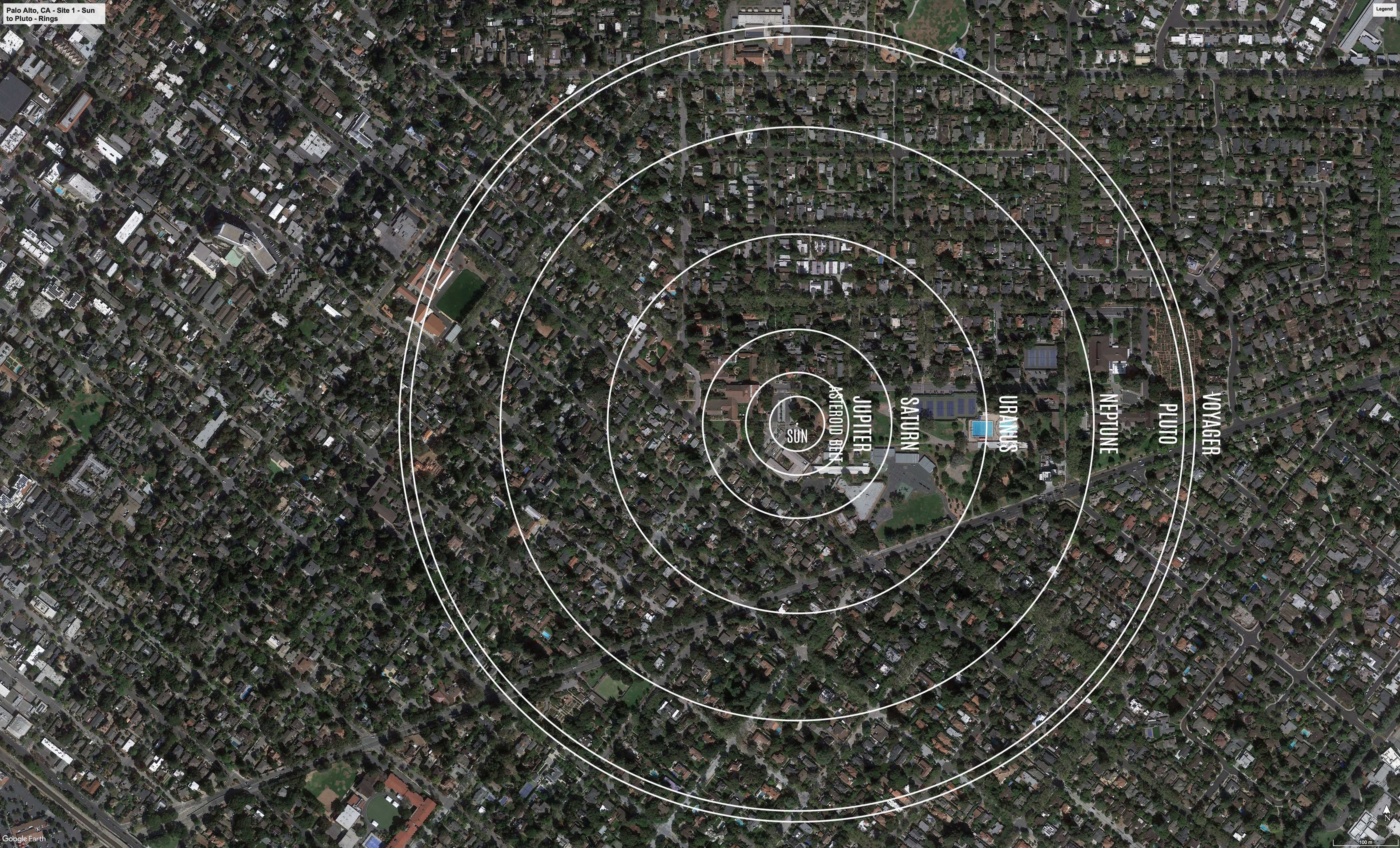
The Outer Solar System orbits from the Asteroid Belt out to Pluto.
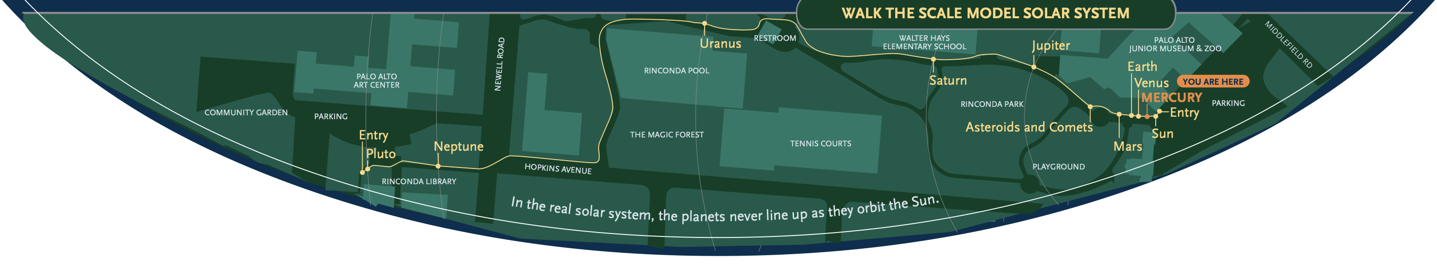
Formal Site Map: A Formal Site Map (FSM) is produced by the community using a CAD map of the site (if available) that is accurate at sub-meter resolution. The FSM identifies the precise locations of the exhibition’s 13 stanchions relative to local buildings, streets, pathways, and green spaces.
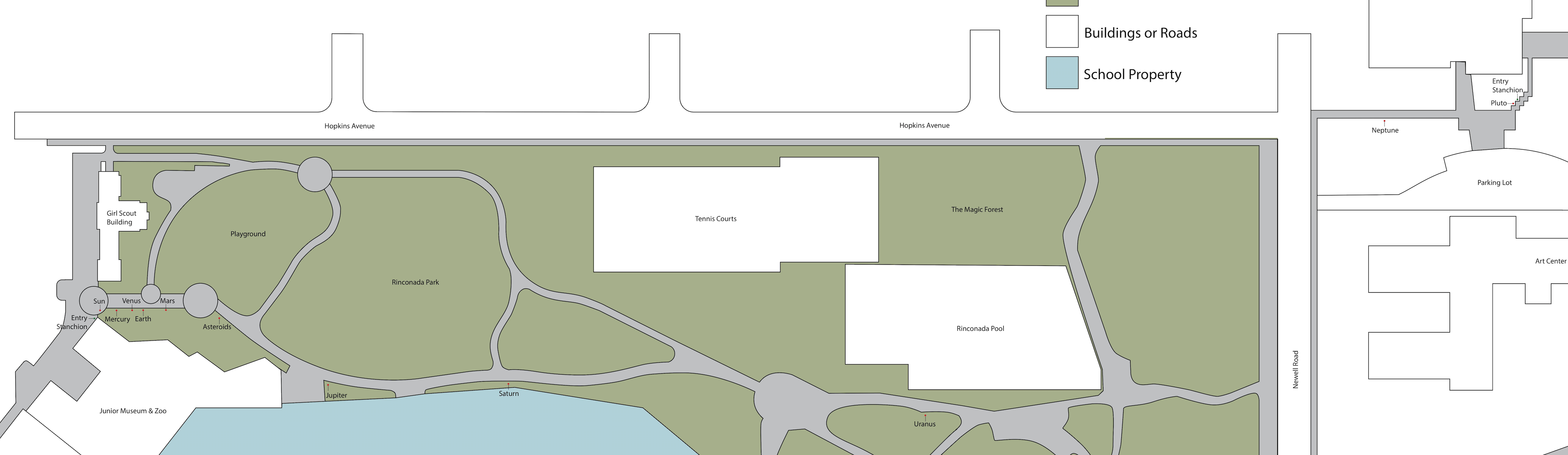
Custom Site Map: If a community has purchased a Customization Upgrade, each of the exhibition’s 13 storyboards includes a Custom Site Map (CSM) created by the designer for the Voyage National Program. The Formal Site Map provided by the community is used to create the CSM, which maintains the Voyage design aesthetic defined by style and color palette. The CSM provides the visitor with wayfinding information relative to local landmarks.