
To see a list and map of all Voyage Communities, visit the Community Network
Opening Date: September 13, 2022
Exhibition Type: Mark II (Generation 1)
Lead Institution:City of Broken Arrow


Partner Institutions:
Broken Arrow Public Schools
Big Kid Science
Broken Arrow Chamber of Commerce
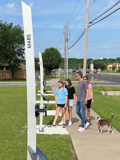
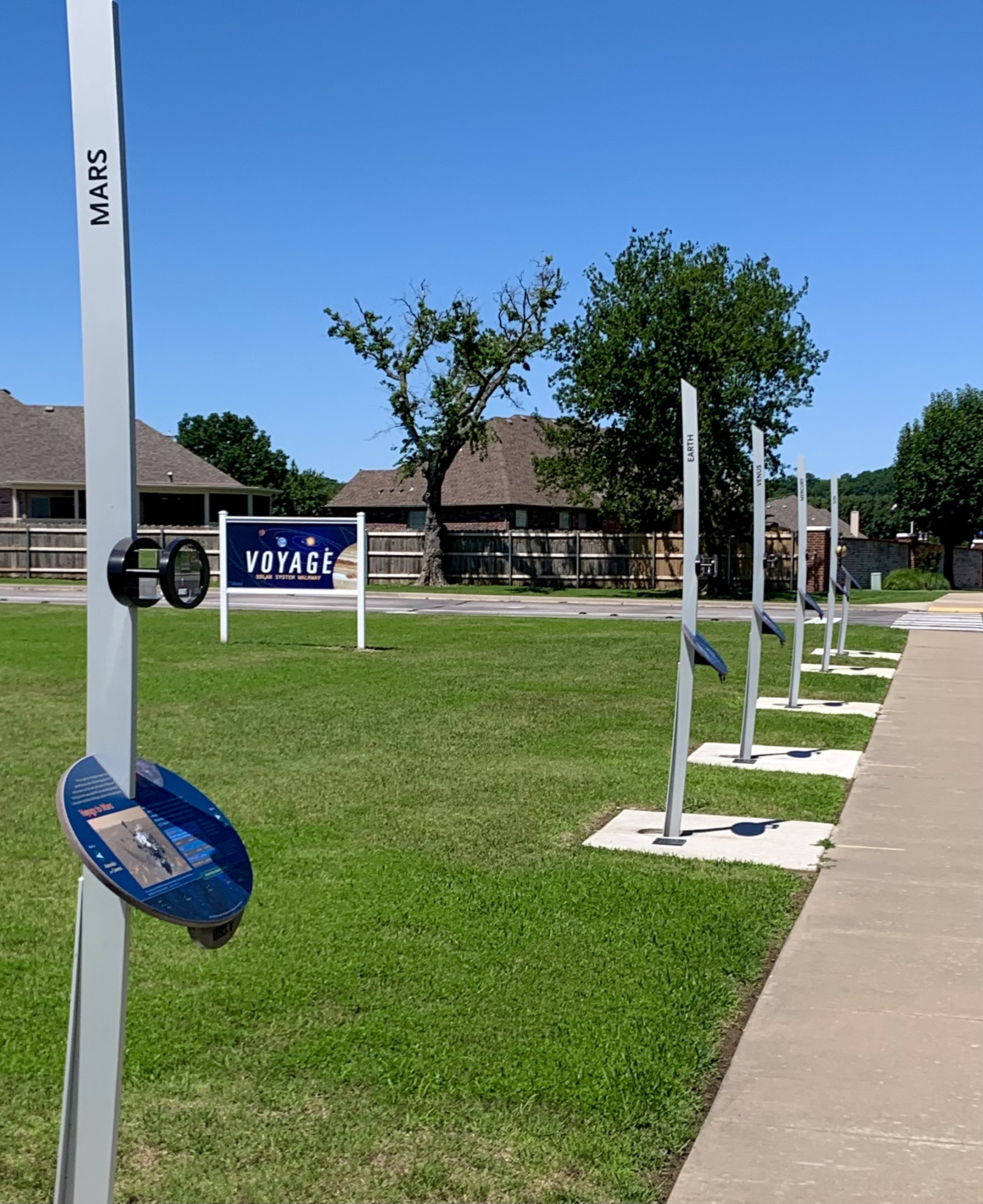
Location: Voyage exhibition entry at Creekwood Elementary School, exhibition extends eastward toward Broken Arrow High School
Overview
Known for the Rose District and the historical Rooster Days Festival, Broken Arrow is the fourth largest city in Oklahoma, yet maintains its small-town charm. In 2020, Broken Arrow claimed the titles of the 11th Safest City in America and the Happiest Place in the state. Broken Arrow boasts both the third largest manufacturing sector and the largest high school in the state.
Click on Image to Zoom
Click on Image to Zoom
Boasting the third-largest manufacturing hub in Oklahoma, companies that set up here rely on a well-educated population. Education is of top priority for the Broken Arrow community and Broken Arrow Schools leads the way in 21st-century education. The mission of Broken Arrow Public Schools is to educate, equip, and empower a community of learners by providing dynamic learning opportunities which enable all students to be successful.
A group of energetic retired educators along with current educators worked many months to bring together all the resources and community support to bring the Voyage Project to life in Broken Arrow. Oklahoma has a legacy of aerospace innovation and success dating back more than 100 years, with pioneers like Wiley Post, who launched his career of exploring the limits of high-altitude, long-distance flight in our state.
Today, some of the world’s most successful aerospace companies operate in Oklahoma. Through our Voyage Project implementation, we will inspire and encourage students to pursue STEM (Science, Technology, Engineering and Math) education and careers, and relate that learning to opportunities in the aerospace and aviation industry. The Voyage exhibit is easily accessible to the community. It stretches across two centralized Broken Arrow Public School Campuses from Creekwood Elementary School to Broken Arrow High School. Its location is less than a mile from BA’s new Vanguard Academy, the district’s new state-of-the-art STEM facility. Students and families from all over Oklahoma have access to the whole Voyage experience.
Implementation Plan
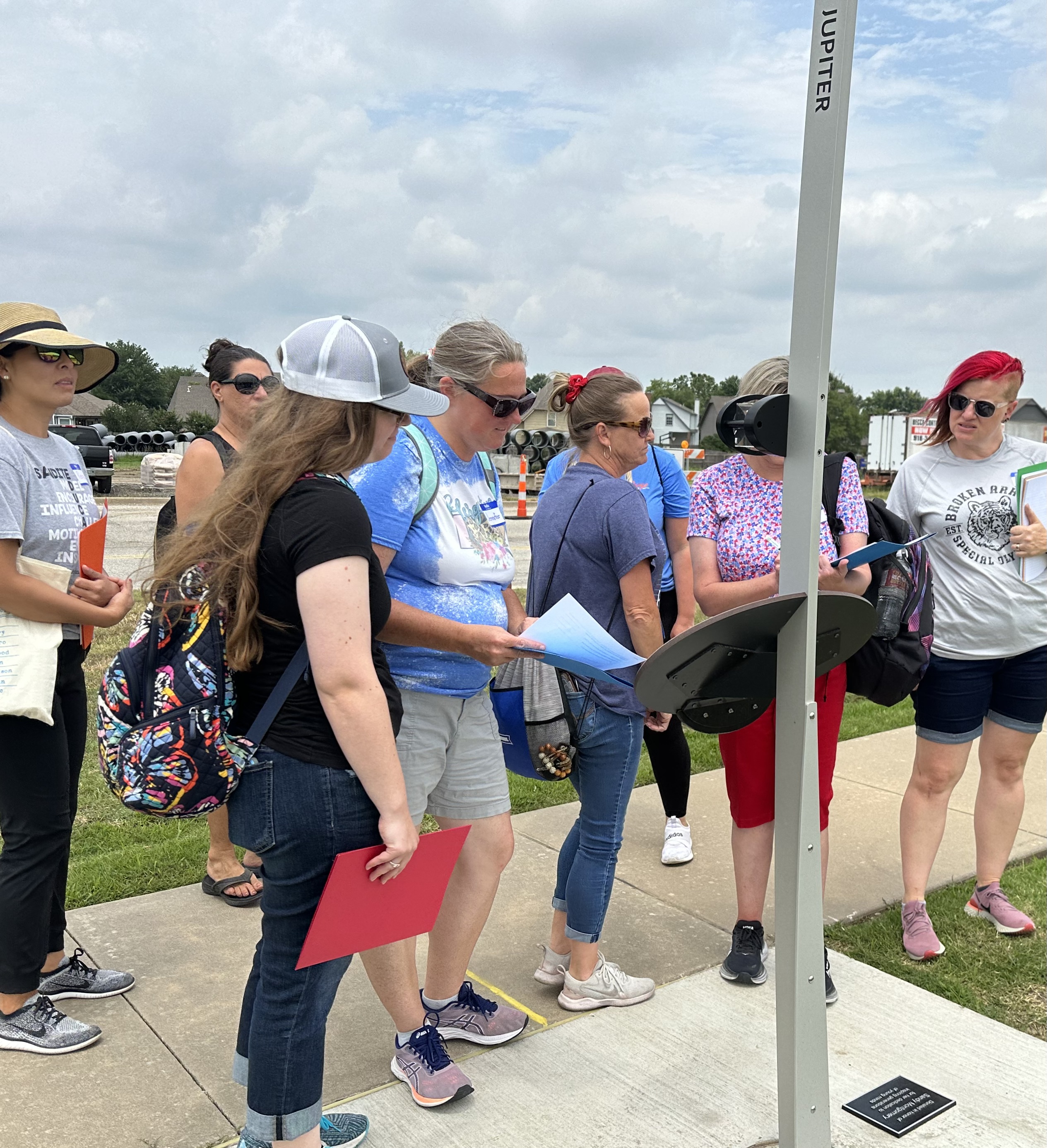
The National Center for Earth and Space Science Education would like to encourage a community to not just install a Voyage exhibition as a passive experience, but proactively put Voyage to work, with e.g., tours, both guided and self-guided, and classroom-based pre- and post-tour lessons on Solar System science and exploration. The community’s lead organization, working in concert with the other partner organizations, submits an Implementation Plan where all collectively propose how the Voyage exhibition and associated educational materials would be used in their community to address the Voyage Key Objectives (see Section 1 here), hopefully in perpetuity.
Download Broken Arrow, OK, Implementation Plan
Click on Image to Zoom
Noteworthy
– The Voyage Team in Broken Arrow created a roadside sign advertising the exhibition. Click on the image at the right.
– Voyage is a Geocaching Adventure Lab site.
Site Maps
To explore the maps below at high resolution, first click on the map and wait for it to load as a pop-up window. If you see the icon ![]() in the upper right corner of the window, you can click on it and explore at higher resolution. Alternatively, you can drag the pop-up window to your desktop to download. Once downloaded, Zoom in to view at higher resolution.
in the upper right corner of the window, you can click on it and explore at higher resolution. Alternatively, you can drag the pop-up window to your desktop to download. Once downloaded, Zoom in to view at higher resolution.
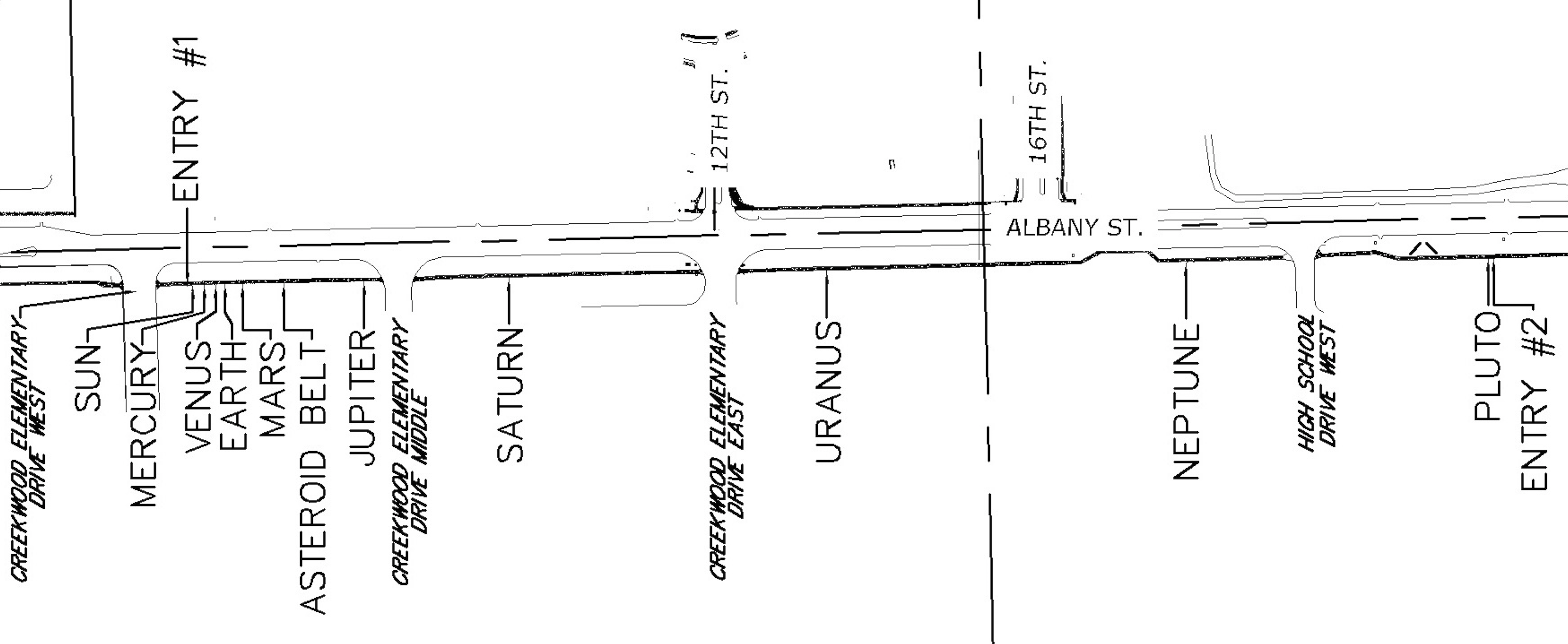
Preliminary Site Maps: To help a community understand how the Voyage model Solar System will lay out at the proposed site, the National Center for Earth and Space Science Education generates Preliminary Site Maps (PSMs), which overlay the proposed position of the Sun and orbits of the planets atop Google Earth images. The radii of the orbits are the average distances of the planets from the Sun at the 1 to 10-billion scale. The PSMs provide an understanding of where the orbits intersect walking paths, so that positions of the exhibitions’s 13 stanchions can be identified.
The Inner Solar System orbits out to the Asteroid Belt.
The Outer Solar System orbits from the Asteroid Belt out to Pluto.
Formal Site Map: A Formal Site Map (FSM) is produced by the community using a CAD map of the site (if available) that is accurate at sub-meter resolution. The FSM identifies the precise locations of the exhibition’s 13 stanchions relative to local buildings, streets, pathways, and green spaces.