To see a list and map of all Voyage Communities, visit the Community Network main page.

Opening Date: August 18, 2022
Exhibition Type: Mark II (Generation 1)
Lead Institution: Region 5 STEM Center, Calcasieu Parish School Board
Partner Institutions:
Allen Parish School Board
Beauregard Parish School Board
Calcasieu Parish Police Jury
Calcasieu Parish School Board
Cameron Parish School Board
Chennault International Airport
CITGO
City of Lake Charles
Community Foundation of Southwest Louisiana
KPLC-TV
McNeese State University
Phillips 66
REC Foundation
Sasol
SOWELA Technical Community College
SWLA Economic Development Alliance
United Way of Southwest Louisiana
Westlake Chemical
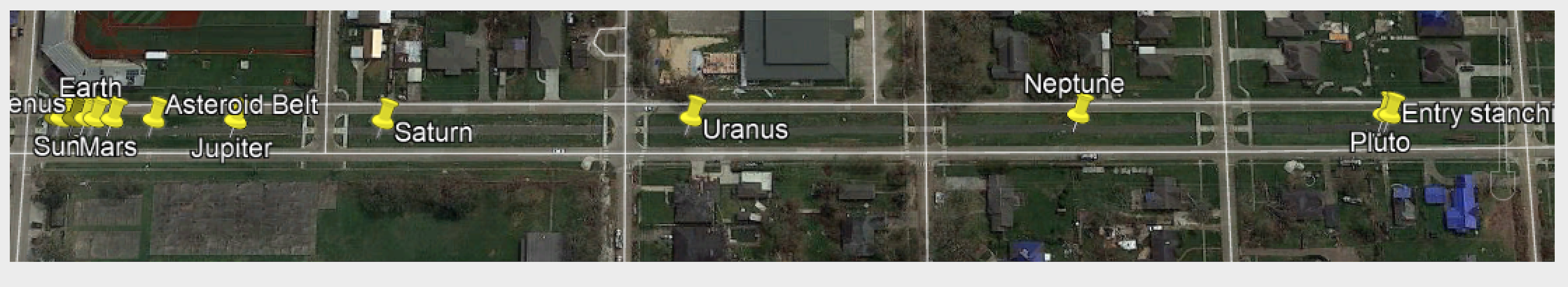
Location: walking path along 1st Avenue
Overview
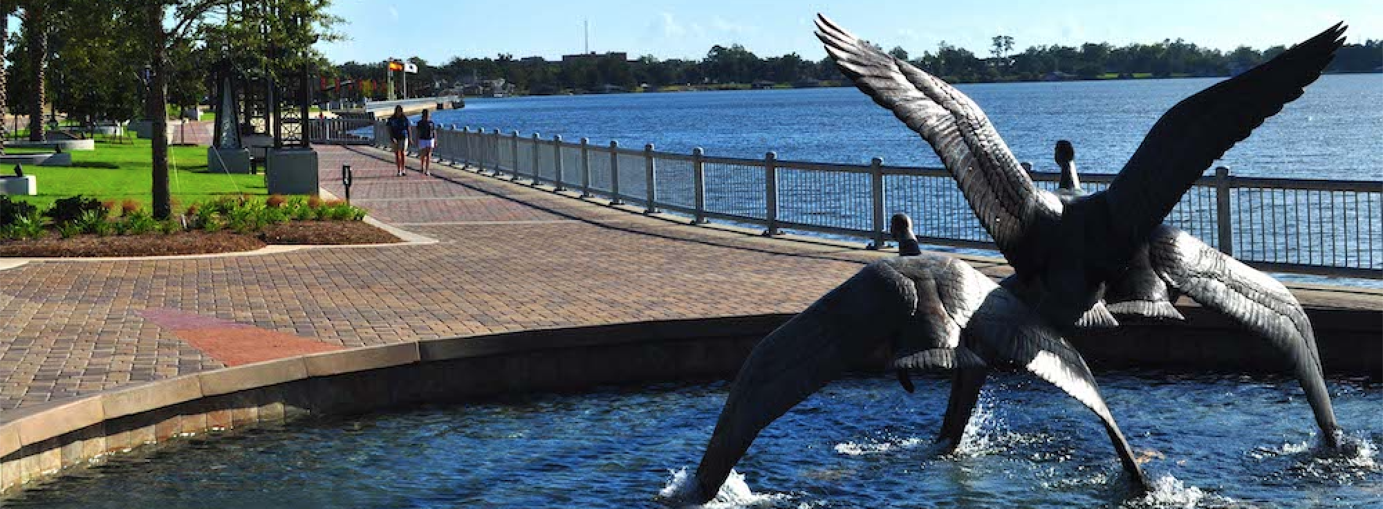
The city of Lake Charles overlooks a freshwater lake with the only white-sand inland beach along the Gulf Coast. Local legends say the pirate Jean Lafitte made Lake Charles, Louisiana his hideaway and left behind hidden treasure on the shores of the lake.
“Hey Marshall, that’s us!”
This legend is celebrated each year with the state’s 2nd longest festival, the Louisiana Pirate Festival. Held annually the first two weeks in May, the festival features a re-enactment of Jean Lafitte and the Buccaneers taking over the city, complete with cannons and a ‘walking of the plank’ by the city’s mayor.
The nightlife is non-stop in Lake Charles, featuring 24-7, Las Vegas-Style gaming on either side of the I-10 Bridge and plenty of nightclubs featuring live music and evening fun. Golfers will enjoy a choice of several popular courses including a nationally ranked facility and for sportsmen, the hunting and fishing in and around Lake Charles, Louisiana is one of its greatest attributes.
The historic Charpentier District is another wonderful attraction in Lake Charles. With its nearly 20 blocks of antique Victorian-era homes, the structures reflect unique Lake Charles-style architecture. Those with an appreciation for history will also enjoy visiting some of the historical area cemeteries and museums.
The Calcasieu Parish School Board (CPSB) is a school district based in Lake Charles, Louisiana. The CPSB operates all public schools in Calcasieu Parish, including the city of Lake Charles. The mission of Calcasieu Parish School Board is to –
Build foundations for the future. We have one chance to build a foundation of knowledge for each student that enters into our system, Pre-k through high school, we are building the very educational groundwork that will shape generations of students into the leaders of Calcasieu Parish and beyond.
– Karl Bruchhaus, Superintendent
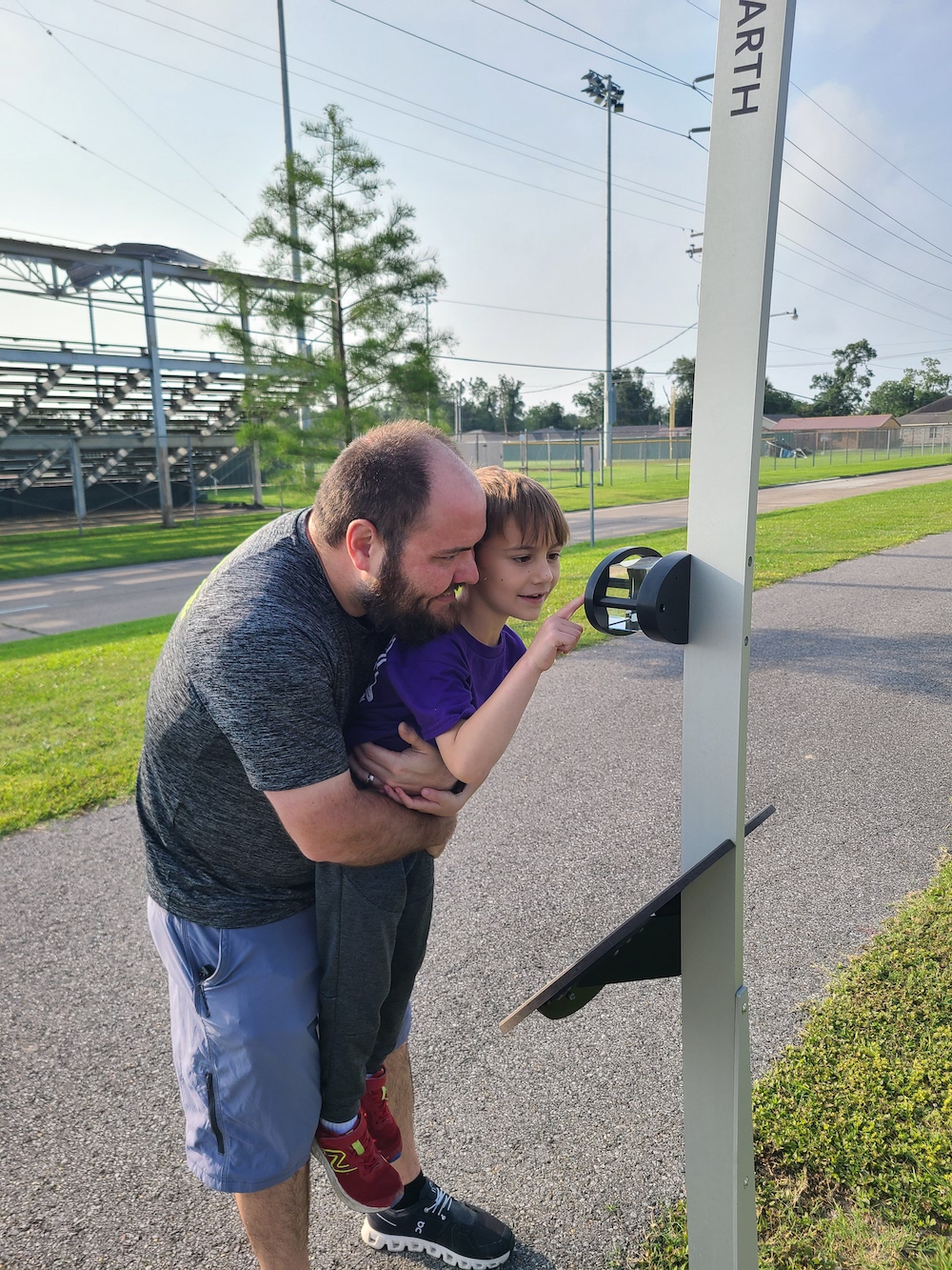
To that end, the Voyage exhibit will serve as an entry point for students, families, and the community to either begin or continue their journey along the STEM pathway. Voyage will serve as an opportunity for teachers to inspire students to think beyond the bounds of this planet, to worlds where critical thinking may not be just a human trait. Visitors to Voyage will be able to enjoy a leisurely walk down the park-like trail that begins along the walking/jogging/biking trail right behind the Region 5 STEM Center at LCB Academy (Lake Charles Boston).
Implementation Plan
The National Center for Earth and Space Science Education would like to encourage a community to not just install a Voyage exhibition as a passive experience, but proactively put Voyage to work, with e.g., tours, both guided and self-guided, and classroom-based pre- and post-tour lessons on Solar System science and exploration. The community’s lead organization, working in concert with the other partner organizations, submits an Implementation Plan where all collectively propose how the Voyage exhibition and associated educational materials would be used in their community to address the Voyage Key Objectives (see Section 1 here), hopefully in perpetuity.
Download Lake Charles, LA, Implementation Plan
Noteworthy
Voyage in Lake Charles is a Geocaching site. Geocaching – join the world’s largest treasure hunt. Comments from Geocachers –
This cache is out of this world.
… a walk in the walkable solar system is amazing.
Site Maps
To explore the maps below at high resolution, first click on the map and wait for it to load as a pop-up window. If you see the icon ![]() in the upper right corner of the window, you can click on it and explore at higher resolution. Alternatively, you can drag the pop-up window to your desktop to download. Once downloaded, Zoom in to view at higher resolution.
in the upper right corner of the window, you can click on it and explore at higher resolution. Alternatively, you can drag the pop-up window to your desktop to download. Once downloaded, Zoom in to view at higher resolution.
Preliminary Site Maps: To help a community understand how the Voyage model Solar System will lay out at the proposed site, the National Center for Earth and Space Science Education generates Preliminary Site Maps (PSMs), which overlay the proposed position of the Sun and orbits of the planets atop Google Earth images. The radii of the orbits are the average distances of the planets from the Sun at the 1 to 10-billion scale. The PSMs provide an understanding of where the orbits intersect walking paths, so that positions of the exhibitions’s 13 stanchions can be identified.
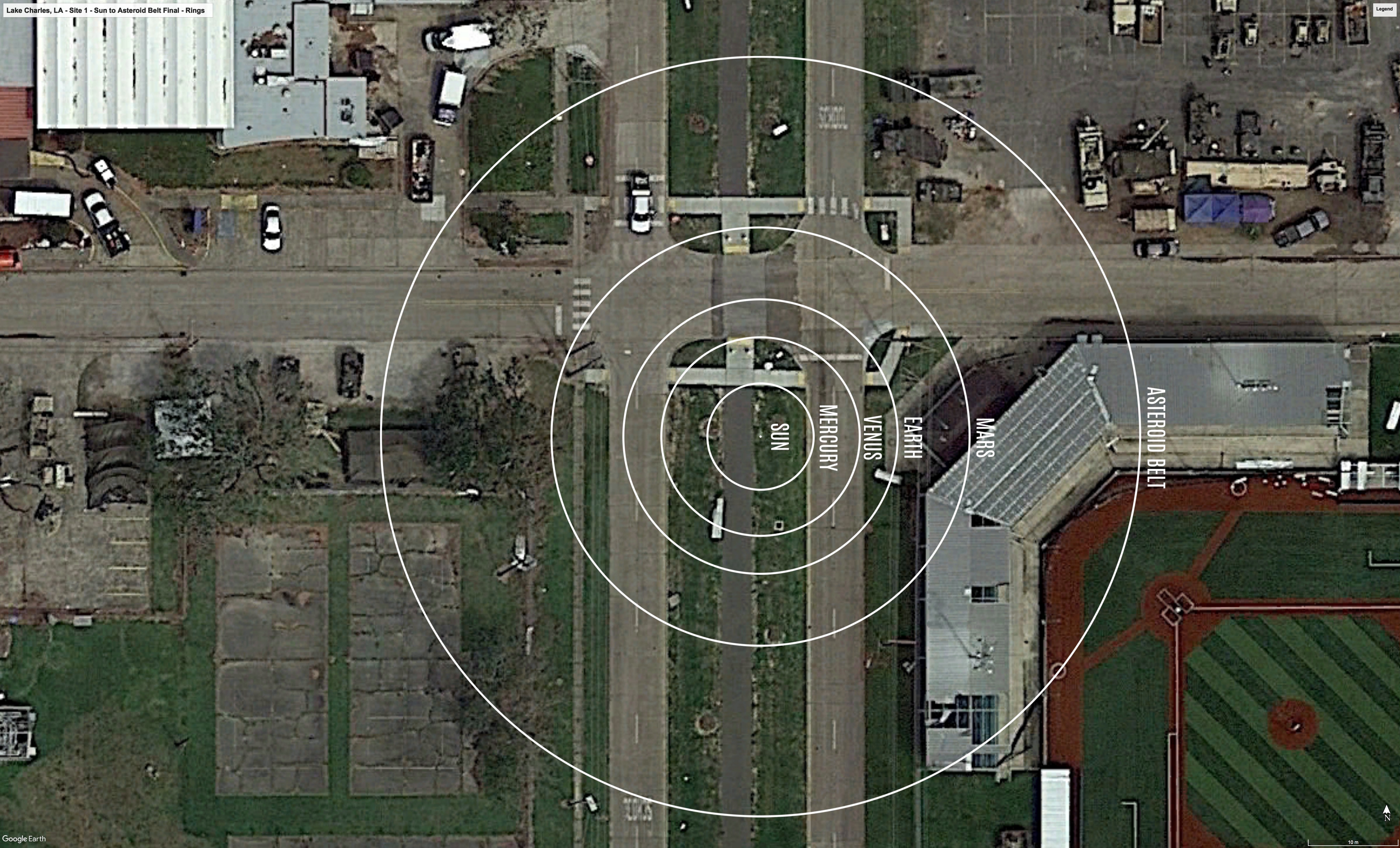
The Inner Solar System orbits out to the Asteroid Belt.
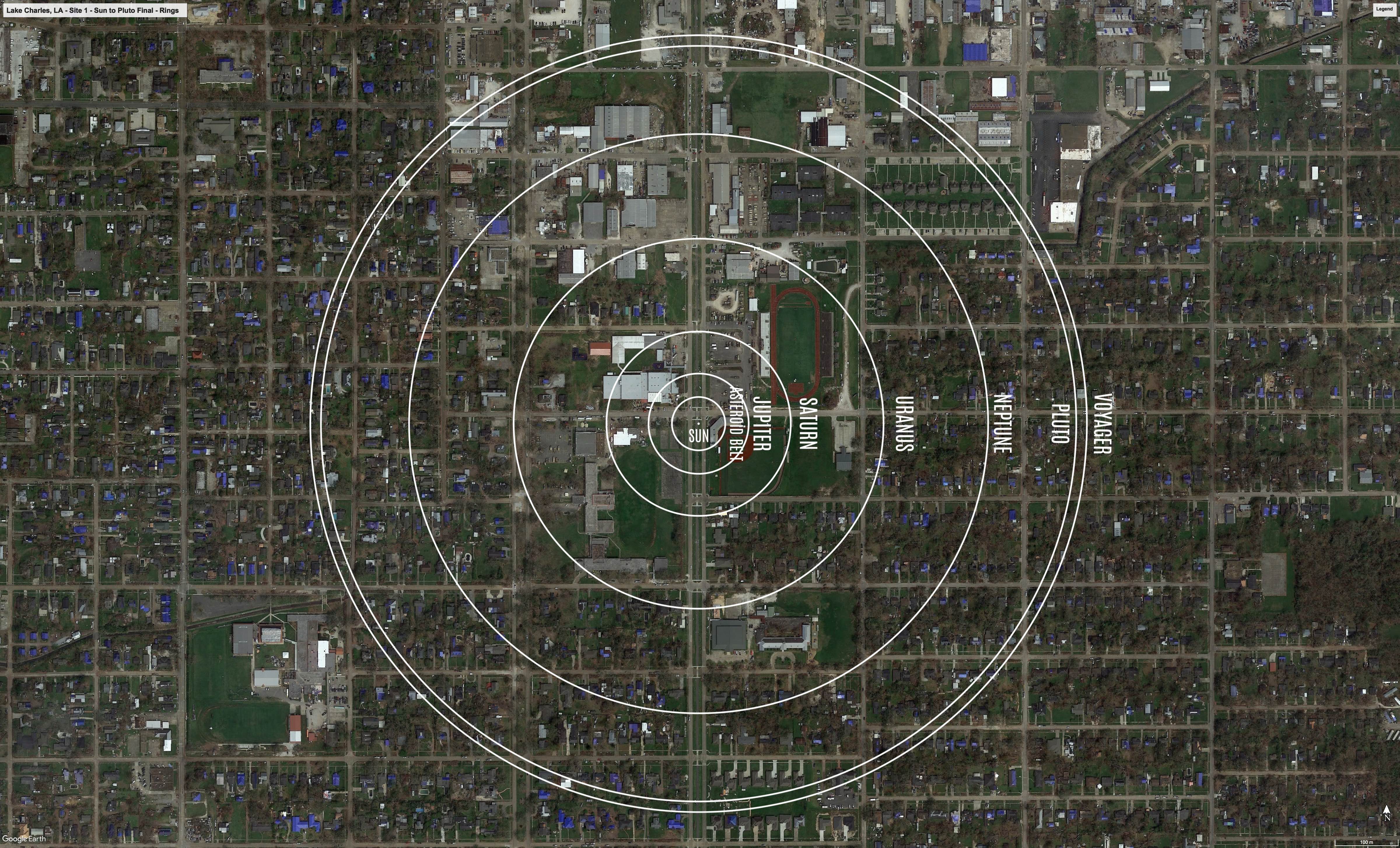
The Outer Solar System orbits from the Asteroid Belt out to Pluto.
Formal Site Map: A Formal Site Map (FSM) is produced by the community using a CAD map of the site (if available) that is accurate at sub-meter resolution. The FSM identifies the precise locations of the exhibition’s 13 stanchions relative to local buildings, streets, pathways, and green spaces.