
To see a list and map of all Voyage Communities, visit the Community Network main page.![]()
Opening Date: September 21, 2022
Exhibition Type: Mark II (Generation 1)
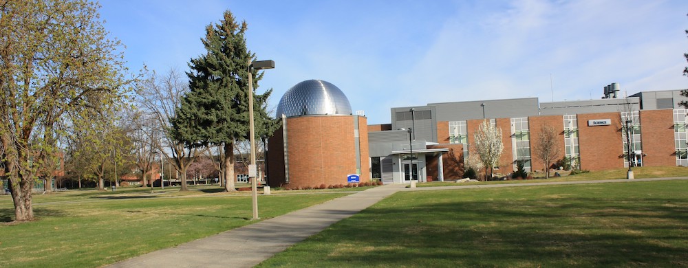
Lead Institution: Spokane Falls Community College
Partner Institutions: none
Proposed Location: Spokane Falls Community College campus
Overview
Spokane is a community of about 300,000 people and is the major population center in the Inland Northwest region (Eastern Washington, Northern Idaho, and Western Montana). There are two colleges in the Community Colleges of Spokane district – Spokane Falls Community College (SFCC) and Spokane Community College – with a combined population of around 30,000 students.
Click on Image to Zoom
SFCC is committed to preparing our students to think critically and globally. Our strategic objectives in STEM education are as follows:
- Identify areas to increase science literacy across the student population, including students not pursuing a STEM-related focus.
- Develop and implement a continuum of STEM outreach opportunities.
- Develop inclusive classroom environments that provide equitable opportunities for learning and engaging in STEM disciplines.
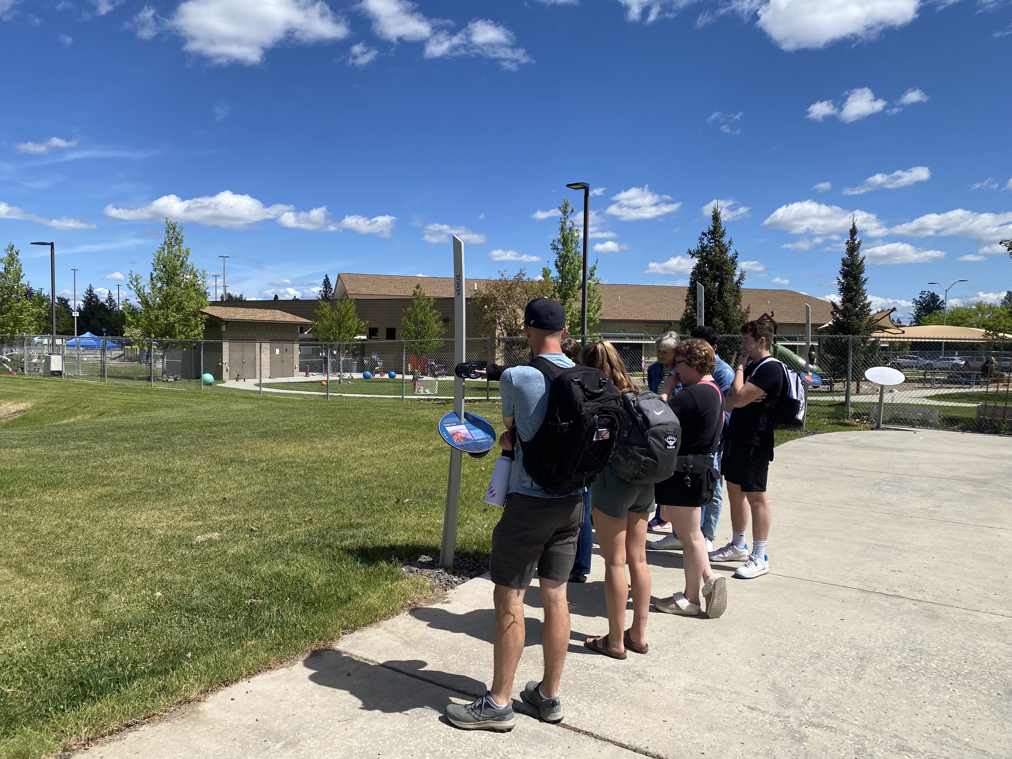
Having a Voyage exhibition on campus will mesh nicely with our first strategic objective. Although many of our students at SFCC are pursuing careers in STEM-related fields, the majority are working on a liberal arts AA degree so they can transfer to a 4-year university in a non-STEM major. A Voyage exhibition will be an excellent way to grab the attention of these students as they walk across campus, and have them stop and think about their place in the universe.
SFCC has a strong tradition of STEM outreach with our community and K-12 area schools. A planetarium was constructed with our new science building in 2010, and we have hosted thousands of K-12 students and community members in public planetariums shows over the past decade. Many of the students attending planetarium shows during field trips also go on a campus tour. The Voyage exhibition would provide a perfect opportunity for these students to spark an interest in science while experiencing the awe-inspiring scale of the solar system.
Our third strategic objective will be enhanced by the multi-disciplinary nature of the Voyage exhibition. Every subject area in STEM is represented in some way with a walk-through scale model of the solar system. We envision many instructors utilizing the exhibition in their classes to teach their students about physics, math, engineering, chemistry, geology, biology, etc. The accessibility of the exhibition for mobility, sight, and hearing-impaired students is also critically important for this objective.
Implementation Plan
The National Center for Earth and Space Science Education would like to encourage a community to not just install a Voyage exhibition as a passive experience, but proactively put Voyage to work, with e.g., tours, both guided and self-guided, and classroom-based pre- and post-tour lessons on Solar System science and exploration. The community’s lead organization, working in concert with the other partner organizations, submits an Implementation Plan where all collectively propose how the Voyage exhibition and associated educational materials would be used in their community to address the Voyage Key Objectives (see Section 1 here), hopefully in perpetuity.
Download Spokane, WA, Implementation Plan
Site Maps
To explore the maps below at high resolution, first click on the map and wait for it to load as a pop-up window. If you see the icon ![]() in the upper right corner of the window, you can click on it and explore at higher resolution. Alternatively, you can drag the pop-up window to your desktop to download. Once downloaded, Zoom in to view at higher resolution.
in the upper right corner of the window, you can click on it and explore at higher resolution. Alternatively, you can drag the pop-up window to your desktop to download. Once downloaded, Zoom in to view at higher resolution.
Preliminary Site Maps: To help a community understand how the Voyage model Solar System will lay out at the proposed site, the National Center for Earth and Space Science Education generates Preliminary Site Maps (PSMs), which overlay the proposed position of the Sun and orbits of the planets atop Google Earth images. The radii of the orbits are the average distances of the planets from the Sun at the 1 to 10-billion scale. The PSMs provide an understanding of where the orbits intersect walking paths, so that positions of the exhibitions’s 13 stanchions can be identified.
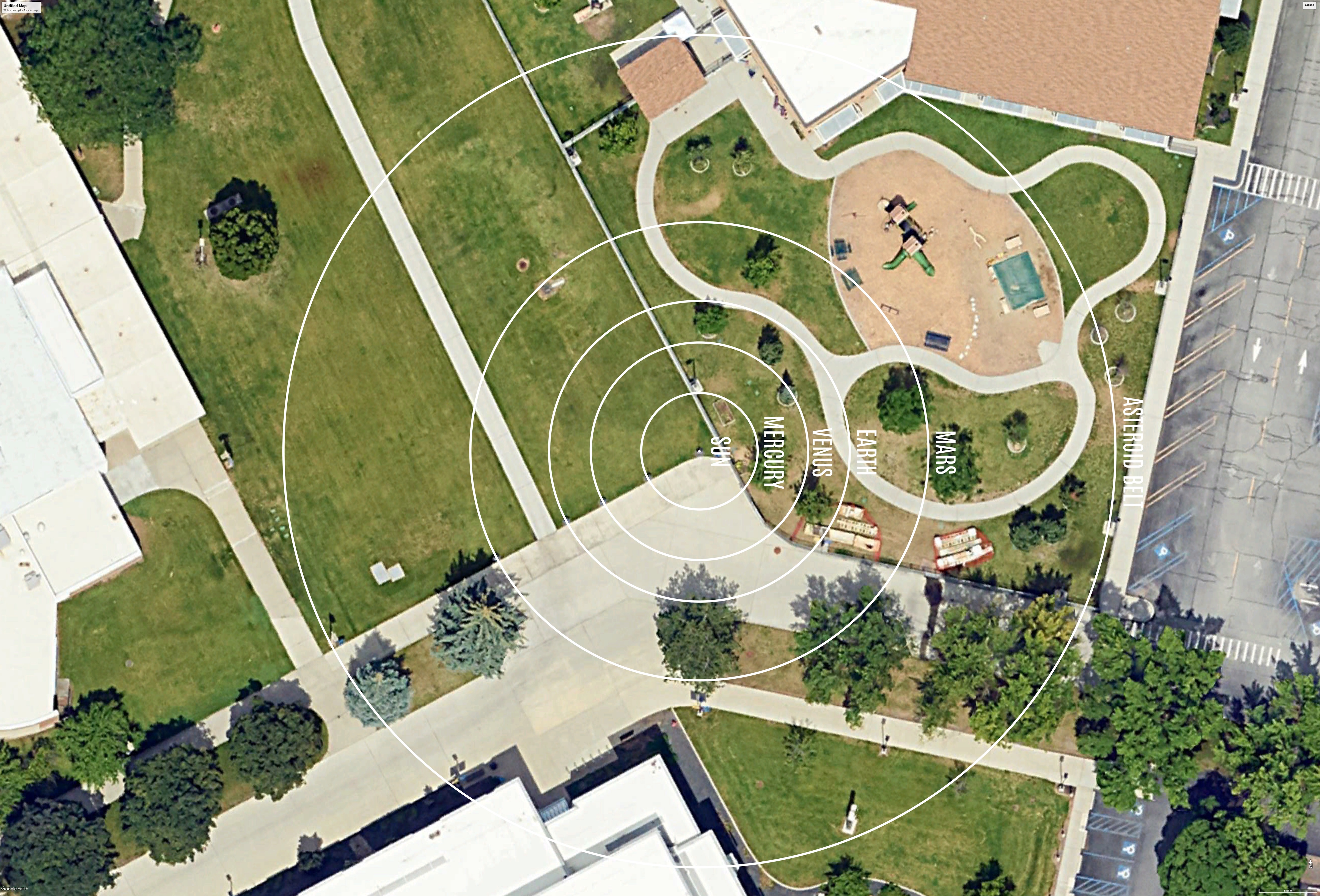
The Inner Solar System orbits out to the Asteroid Belt.
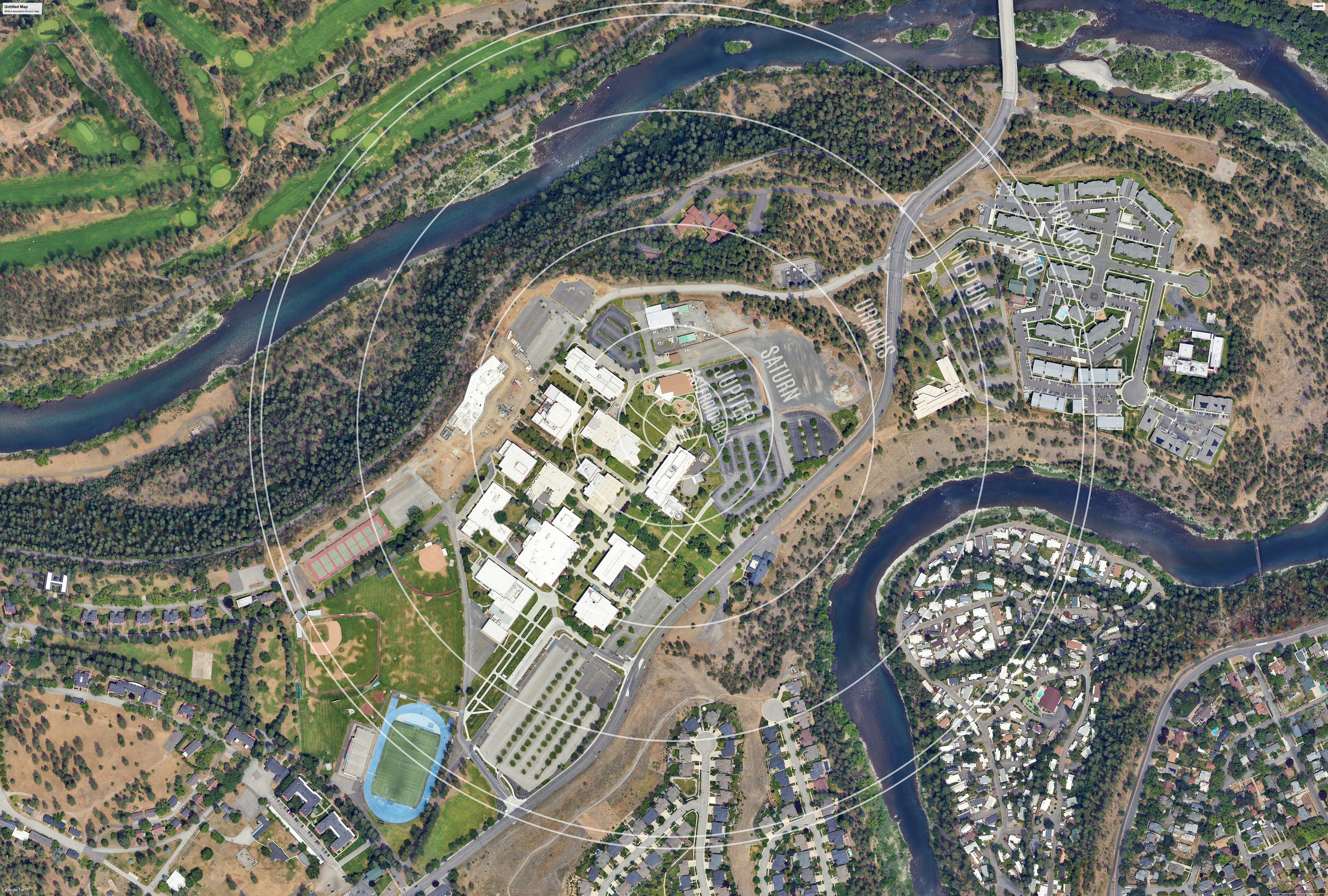
The Outer Solar System orbits from the Asteroid Belt out to Pluto.
Formal Site Maps: A Formal Site Map (FSM) is produced by the community using a CAD map of the site (if available) that is accurate at sub-meter resolution. The FSM identifies the precise locations of the exhibition’s 13 stanchions relative to local buildings, streets, pathways, and green spaces.
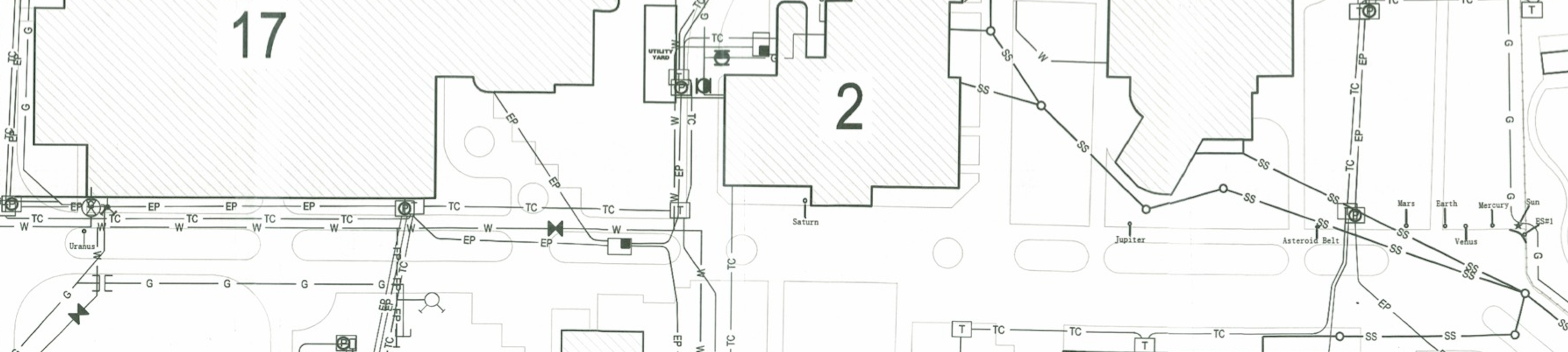
Sun to Uranus
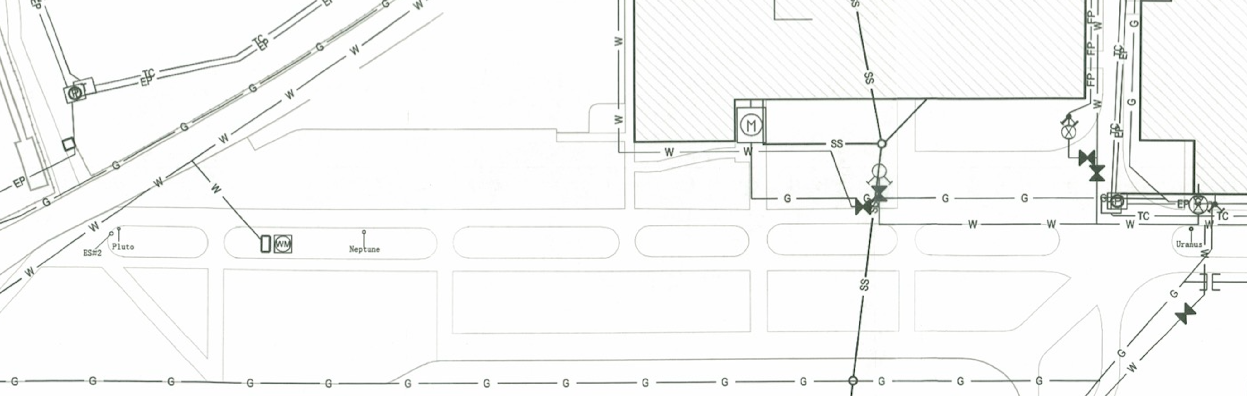
Uranus to Pluto